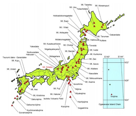
Sometimes, natural disasters caused by volcanic eruptions have tragic consequences. Phreatic eruptions are large explosions of steam rocks and hot water caused by the sudden evaporation of water to steam. The September 2014 eruption of Mt. Ontake in Japan was the deadliest in recorded history. Numerous studies have analyzed the occurrence of phreatic eruptions of Mt. Ontake. However, at present, although it is explained that the magma did not move, studies on the cause of the eruption and the elucidation of the process are limited. This study investigates the role of external water of meteoric origin and determines its role in the eruption process. According to a survey of rainfall records by the Japan Meteorological Agency, heavy rain that broke historical records occurred immediately before the phreatic eruption of Mt. Ontake. It was hypothesized that extreme rainfall was the source of the external water supply that caused the phreatic eruption without the magma moving. Various studies on eruptions have confirmed the consistency of this hypothesis. Regarding the eruptive process, extreme rainfall collided with the hot rocks outside the magma chamber, triggering frequent occurrences of vaporization associated with boiling, leading to large explosions in sealed rocks above the zone of water infiltration. This research can contribute to disaster prevention in the future. In order to achieve this, it is necessary to install rainfall measuring instruments on all volcanoes and perform a comparative, multidisciplinary approach to all the monitored parameters.
Citation: Nobuo Uchida. Effects of extreme rainfall on phreatic eruptions: A case study of Mt. Ontake in Japan[J]. AIMS Geosciences, 2024, 10(2): 208-227. doi: 10.3934/geosci.2024012
Sometimes, natural disasters caused by volcanic eruptions have tragic consequences. Phreatic eruptions are large explosions of steam rocks and hot water caused by the sudden evaporation of water to steam. The September 2014 eruption of Mt. Ontake in Japan was the deadliest in recorded history. Numerous studies have analyzed the occurrence of phreatic eruptions of Mt. Ontake. However, at present, although it is explained that the magma did not move, studies on the cause of the eruption and the elucidation of the process are limited. This study investigates the role of external water of meteoric origin and determines its role in the eruption process. According to a survey of rainfall records by the Japan Meteorological Agency, heavy rain that broke historical records occurred immediately before the phreatic eruption of Mt. Ontake. It was hypothesized that extreme rainfall was the source of the external water supply that caused the phreatic eruption without the magma moving. Various studies on eruptions have confirmed the consistency of this hypothesis. Regarding the eruptive process, extreme rainfall collided with the hot rocks outside the magma chamber, triggering frequent occurrences of vaporization associated with boiling, leading to large explosions in sealed rocks above the zone of water infiltration. This research can contribute to disaster prevention in the future. In order to achieve this, it is necessary to install rainfall measuring instruments on all volcanoes and perform a comparative, multidisciplinary approach to all the monitored parameters.

| [1] |
Oikawa T, Yoshimoto M, Nakada S, et al. (2016) Reconstruction of the 2014 eruption sequence of Ontake volcano from recorded images and interviews. Earth Planet Sp 68: 79. https://doi.org/10.1186/s40623-016-0458-5 doi: 10.1186/s40623-016-0458-5

|
| [2] | The Japan Meteorological Agency, 50 Volcanoes That Require Enhanced Monitoring and Observation Systems for Volcanic Disaster Prevention Available from the following. Available from: https://www.data.jma.go.jp/vois/data/tokyo/STOCK/kaisetsu/katsukazan_toha/katsukazan_toha.html#kanshikazan. |
| [3] | Yamaoka K, Geshi N, Hashimoto T, et al. (2016) The phreatic eruption of Mt. Ontake volcano in 2014. Earth Planet Sp 68: 175. https://doi.org/10.1186/s40623-016-0548-4 |
| [4] | Kaneko T, Maeno F, Nakada S (2014) Mt. Ontake eruption: characteristics of the phreatic eruption as inferred from aerial observations. Earth Planet Sp 68: 1–11. |
| [5] |
Maeno F, Nakada S, Oikawa T, et al. (2016) Reconstruction of a phreatic eruption on 27 September 2014 at Ontake volcano, central Japan, based on proximal pyroclastic density current and fallout deposits. Earth Planet Sp 68: 82. https://doi.org/10.1186/s40623-016-0449-6 doi: 10.1186/s40623-016-0449-6
|
| [6] |
Farquharson JI, Amelung F (2020) Extreme rainfall triggered the 2018 rift eruption at Kīlauea volcano. Nature 580: 491–495. https://doi.org/10.1038/s41586-020-2172-5 doi: 10.1038/s41586-020-2172-5
|
| [7] |
Barclay J, Johnstone JE, Matthews AJ (2006) Meteorological monitoring of an active volcano: implications for eruption prediction. J Volcanol Geotherm Res 150: 339–358. https://doi.org/10.1016/j.jvolgeores.2005.07.020 doi: 10.1016/j.jvolgeores.2005.07.020
|
| [8] |
Aubry TJ, Farquharson JI, Rowell CR, et al. (2022) Impact of climate change on volcanic processes: current understanding and future challenges. Bull Volcanol 84: 58. https://doi.org/10.1007/s00445-022-01562-8 doi: 10.1007/s00445-022-01562-8
|
| [9] |
Simmons J, Elsworth D, Voight B (2004) Instability of exogenous lava lobes during intense rainfall. Bull Volcanol 66: 725–734. https://doi.org/10.1007/s00445-004-0353-y doi: 10.1007/s00445-004-0353-y
|
| [10] |
Farquharson JI, Amelung F (2022) Volcanic hazard exacerbated by future global warming-driven increase in heavy rainfall. R Soc Open Sci 9: 220275. https://doi.org/10.1098/rsos.220275 doi: 10.1098/rsos.220275
|
| [11] |
Stix J, de Moor JM (2018) Understanding and forecasting phreatic eruptions driven by magmatic degassing. Earth Planet Sp 70: 83. https://doi.org/10.1186/s40623-018-0855-z doi: 10.1186/s40623-018-0855-z
|
| [12] |
Minami Y, Imura T, Hayashi S, et al. (2016) Mineralogical study on volcanic ash of the eruption on September 27, 2014 at Ontake volcano, central Japan: correlation with porphyry copper systems. Earth Planet Sp 68: 67. https://doi.org/10.1186/s40623-016-0440-2 doi: 10.1186/s40623-016-0440-2
|
| [13] | Takagi A, Onizawa S (2016) Shallow pressure sources associated with the 2007 and 2014 phreatic eruptions of MT. Ontake, Japan. Earth Planet Sp 68: 135. https://doi.org/10.1186/s40623-016-0515-0 |
| [14] |
Sasaki H, Chiba T, Kishimoto H, et al. (2016) Characteristics of the syneruptive-spouted type lahar generated by the September 2014 eruption of Mount Ontake, Japan. Earth Planet Sp 68: 141. https://doi.org/10.1186/s40623-016-0516-z doi: 10.1186/s40623-016-0516-z
|
| [15] |
Ikehata K, Maruoka T (2016) Sulfur isotopic characteristics of volcanic products from the September 2014 mount ontake eruption, Japan. Earth Planet Sp 68: 116. https://doi.org/10.1186/s40623-016-0496-z doi: 10.1186/s40623-016-0496-z
|
| [16] | Miyaoka K, Takagi A (2016) Detection of crustal deformation prior to the 2014 Mt. Ontake eruption by the stacking method. Earth Planet Sp 68: 60. https://doi.org/10.1186/s40623-016-0439-8 |
| [17] | Mount Ontake Volcano Research Facility. Available from: https://www.seis.nagoya-u.ac.jp/center/kovo/midokoro/midokoro_detail06.html. |
| [18] |
Caudron C, Aoki Y, Lecocq L, et al. (2022) Hidden pressurized fluids prior to the 2014 phreatic eruption at Mt Ontake. Nat Commun 13: 6145. https://doi.org/10.1038/s41467-022-32252-w doi: 10.1038/s41467-022-32252-w
|
| [19] | Japan Meteorological Agency, AMeDAS (Automated Meteorological Data Acquisition System), a Weather Observation Instrument. Available from: https://www.jma.go.jp/jma/kishou/know/amedas/kaisetsu.html. |
| [20] | Japan Meteorological Agency, AMeDAS, The Monthly and Annual Rainfall of Mt. Ontake in 2006 or 2021. Available from: https://www.data.jma.go.jp/obd/stats/etrn/index.php?prec_no=48&block_no=0416&year=&month=&day=&view=. |
| [21] | Japan Meteorological Agency, A Meteorological Example of Typhoon No. 20 Hitting Japan in 1979. Available from: https://www.data.jma.go.jp/obd/stats/data/bosai/report/1979/19791010/19791010.html. |
| [22] | Japan Meteorological Agency, Weather Examples of Typhoons No. 11 and No. 12 that Hit Japan in 2014. Available from: https://www.data.jma.go.jp/obd/stats/data/bosai/report/2014/20140730/jyun_sokuji20140730-0811.pdf. |
| [23] | Japan Meteorological Agency, The Rainfall Amount for August 1979 According to AMeDAS. Available from: https://www.data.jma.go.jp/obd/stats/etrn/view/daily_a1.php?prec_no=48&block_no=0416&year=1979&month=08&day=&view=p1. |
| [24] | Japan Meteorological Agency, The Rainfall Amount for September 1979 According to AMeDAS. Available from: https://www.data.jma.go.jp/obd/stats/etrn/view/daily_a1.php?prec_no=48&block_no=0416&year=1979&month=09&day=&view=p1. |
| [25] | Japan Meteorological Agency, The Rainfall Amount for October 1979 According to AMeDAS. Available from: https://www.data.jma.go.jp/obd/stats/etrn/view/daily_a1.php?prec_no=48&block_no=0416&year=1979&month=10&day=&view=. |
| [26] | Japan Meteorological Agency, The Rainfall in July 2014 by AMeDAS. Available from: https://www.data.jma.go.jp/obd/stats/etrn/view/daily_a1.php?prec_no=48&block_no=0416&year=2014&month=07&day=&view=p1. |
| [27] | Japan Meteorological Agency, The Rainfall in August 2014 by AMeDAS. Available from: https://www.data.jma.go.jp/obd/stats/etrn/view/daily_a1.php?prec_no=48&block_no=0416&year=2014&month=8&day=&view=. |
| [28] | Japan Meteorological Agency, The Rainfall amount for September 2014 according to AMeDAS. Available from: https://www.data.jma.go.jp/obd/stats/etrn/view/daily_a1.php?prec_no=48&block_no=0416&year=2014&month=09&day=&view=p1. |
| [29] |
Ogiso M, Matsubayashi H, Yamamoto T (2015) Descent of tremor source locations before the 2014 phreatic eruption of Ontake volcano, Japan. Earth Planet Sp 67: 206. https://doi.org/10.1186/s40623-015-0376-y doi: 10.1186/s40623-015-0376-y
|
| [30] | Maeda Y, Kato A, Terakawa T, et al. (2015) Source mechanism of a VLP event immediately before the 2014 eruption of Mt. Ontake, Japan. Earth Planet Sp 67: 187. https://doi.org/10.1186/s40623-015-0358-0 |
| [31] |
Kato A, Terakawa T, Yamanaka Y, et al. (2015) Preparatory and precursory processes leading up to the 2014 phreatic eruption of Mount Ontake, Japan. Earth Planet Sp 67: 111. https://doi.org/10.1186/s40623-015-0288-x doi: 10.1186/s40623-015-0288-x
|
| [32] | Volcano Division, Earthquake and Volcanology Department, Japan Meteorological Agency (May 2014) Volcanic Eruption Prediction Coordination Committee Bulletin No. 119, Volcanic Activities of Mt. Ontake (May 2014 to October 13, 2014), Available from: https://www.data.jma.go.jp/vois/data/tokyo/STOCK/kaisetsu/CCPVE/Report/119/kaiho_119_08.pdf |
| [33] |
Gaete A, Walter TR, Bredemeyer S, et al. (2020) Processes culminating in the 2015 phreatic explosion at Lascar volcano, Chile, monitored by multiparametric data. Nat Hazards Earth Syst 20: 377–397. https://doi.org/10.5194/nhess-20-377-2020 doi: 10.5194/nhess-20-377-2020
|
| [34] |
Strehlow K, Sandri L, Gottsmann JH, et al. (2017) Phreatic eruptions at crater lakes: occurrence statistics and probabilistic hazard forecast. J Appl Volcanol 6: 4. https://doi.org/10.1186/s13617-016-0053-2.45 doi: 10.1186/s13617-016-0053-2.45
|
| [35] | Maeda Y, Watanabe T (2023) Seismic structure and its implication on the hydrothermal system beneath Mt. Ontake, central Japan. Earth Planet Sp 75: 1–115. https://doi.org/10.1186/s40623-023-01870-z |
| [36] | Japan Meteorological Agency, The Rainfall Amount of Mt. Aso on July 18, 2016, According to AMeDAS in Minamiaso, Kumamoto Prefecture. Available from: https://www.data.jma.go.jp/obd/stats/etrn/view/daily_a1.php?prec_no=86&block_no=1660&year=2016&month=07&day=&view=p1. |
| [37] | Japan Meteorological Agency, The Rainfall Amount for Mt. Aso on July 8, 2020, According to AMeDAS in Minamiaso, Kumamoto Prefecture Japan Meteorological Agency. Available from: https://www.data.jma.go.jp/obd/stats/etrn/view/daily_a1.php?prec_no=86&block_no=1660&year=2020&month=07&day=&view=p1. |
| [38] | Japan Meteorological Agency, The Rainfall Amount for Mt. Aso on August 14, 2021, According to AMeDAS in Minamiaso, Kumamoto Prefecture Japan Meteorological Agency, Aug 2021. Available from: https://www.data.jma.go.jp/obd/stats/etrn/view/daily_a1.php?prec_no=86&block_no=1660&year=2021&month=08&day=&view=p1. |
| [39] | Japan Meteorological Agency, The Rainfall Amount for Suwanosejima on July 8, 2020, According to AMeDAS for Su Wanosejima, Kagoshima Prefecture. Available from: https://www.data.jma.go.jp/obd/stats/etrn/view/daily_a1.php?prec_no=88&block_no=1654&year=2020&month=7&day=&view=. |
| [40] | Japan Meteorological Agency, The Rainfall Amount for mt. Asama on August 2: 2019 According to AMeDAS in Tomi, Na Gano Prefecture. Available from: https://www.data.jma.go.jp/obd/stats/etrn/view/daily_a1.php?prec_no=48&block_no=0993&year=2019&month=8&day=&view=. |
| [41] | Japan Meteorological Agency, The Rainfall Amount for Motoshirane on July 6, 2017 of the Previous Year According to Ame DAS in Kusatsu, Gunma Prefecture. Available from: https://www.data.jma.go.jp/obd/stats/etrn/view/daily_a1.php?prec_no=42&block_no=0343&year=2017&month=07&day=&view=p1. |
| [42] | Japan Meteorological Agency, The Rainfall Amount for Sakurajima in June 2019 According to AMeDAS in Kagoshima, Ka Goshima Prefecture. Available from: https://www.data.jma.go.jp/obd/stats/etrn/view/daily_s1.php?prec_no=88&block_no=47827&year=2019&month=06&day=&view=p1. |
| [43] | Japan Meteorological Agency, The Rainfall Amount for Sakurajima in July 2019 According to AMeDAS in Kagoshima, Ka Goshima Prefecture. Available from: https://www.data.jma.go.jp/obd/stats/etrn/view/daily_s1.php?prec_no=88&block_no=47827&year=2019&month=07&day=&view=p1. |
| [44] | Japan Meteorological Agency, Hakone, Kanagawa Prefecture The Rainfall Amount for Mt. Hakone April 20: 2015 According to AMeDAS in Hakone. Available from: https://www.data.jma.go.jp/stats/etrn/view/daily_a1.php?prec_no=46&block_no=0390&year=2015&month=4&day=&view=. |


Figures(6) / Tables(2)

Nobuo Uchida. Effects of extreme rainfall on phreatic eruptions: A case study of Mt. Ontake in Japan[J]. AIMS Geosciences, 2024, 10(2): 208-227. doi: 10.3934/geosci.2024012


 DownLoad: