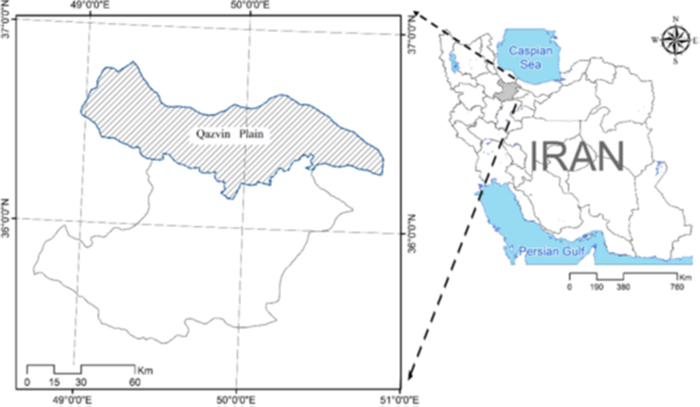
Given the critical role of precise meteorological parameter estimation in water resources management, particularly concerning the water footprint (WF) concept and considering the scarcity of data, this study utilized thirty years of data from four meteorological datasets to estimate the WF of two main cereals, wheat and maize, in Qazvin province, Iran. AquaCrop was used to calculate the WF parameters based on a synoptic station and the closest datasets to the synoptic station. Coefficient of determination (R2), root-mean-square deviation (RMSE) and its normalization (NRMSE), and maximum error (ME) were used to compare the results. The results showed that these datasets efficiently estimate the WF components and can be used instead of synoptic stations. Also, all datasets were more efficient in estimating the green WF than the blue WF. The Global Precipitation Climatology Center (GPCC) dataset was the most efficient dataset in assessing the WF components for wheat, where the RMSE and NRMSE were 84.8 m3/ton and 17.18%. These amounts were 55.1 m3/ton and 12.96% for the green WF. For estimating the blue WF of maize, the Climatic Research Unit (CRU) datasets were the most efficient datasets in assessing the WF components of maize, which were 35.58 m3/ton and 15.91%. This study demonstrated the robustness of meteorological datasets in accurately estimating the components of the WF. Furthermore, the study advocates for the utilization of diverse datasets in estimating meteorological and crop parameters, recommending this approach for different crops across various regions.
Citation: Hadi Ramezani Etedali, Faraz Gorginpaveh, Parisa Kakvand, Ahmed Elbeltagi, Brian Collins. Evaluation of meteorological datasets in estimating the water footprint components of wheat and maize (case study: Qazvin, Iran)[J]. AIMS Agriculture and Food, 2024, 9(1): 84-107. doi: 10.3934/agrfood.2024006
Given the critical role of precise meteorological parameter estimation in water resources management, particularly concerning the water footprint (WF) concept and considering the scarcity of data, this study utilized thirty years of data from four meteorological datasets to estimate the WF of two main cereals, wheat and maize, in Qazvin province, Iran. AquaCrop was used to calculate the WF parameters based on a synoptic station and the closest datasets to the synoptic station. Coefficient of determination (R2), root-mean-square deviation (RMSE) and its normalization (NRMSE), and maximum error (ME) were used to compare the results. The results showed that these datasets efficiently estimate the WF components and can be used instead of synoptic stations. Also, all datasets were more efficient in estimating the green WF than the blue WF. The Global Precipitation Climatology Center (GPCC) dataset was the most efficient dataset in assessing the WF components for wheat, where the RMSE and NRMSE were 84.8 m3/ton and 17.18%. These amounts were 55.1 m3/ton and 12.96% for the green WF. For estimating the blue WF of maize, the Climatic Research Unit (CRU) datasets were the most efficient datasets in assessing the WF components of maize, which were 35.58 m3/ton and 15.91%. This study demonstrated the robustness of meteorological datasets in accurately estimating the components of the WF. Furthermore, the study advocates for the utilization of diverse datasets in estimating meteorological and crop parameters, recommending this approach for different crops across various regions.

| [1] | Massah Bavani A, Morid S (2006) Assessment Aquacrop Model to predict the sugarcane yield and soil salinity profiles under salinity stress. J Sci Technol Agric Nat Resour 9: 273–290. |
| [2] |
del Refugio Barba-López M, Filonov A, Alcocer J, et al. (2021) Complex interactions between meteorological parameters and the thermal regime of two tropical, high altitude crater lakes (Nevado de Toluca, Mexico). Sci Total Environ 771: 145310. https://doi.org/10.1016/j.scitotenv.2021.145310 doi: 10.1016/j.scitotenv.2021.145310

|
| [3] |
Elbeltagi A, Deng J, Wang K, et al. (2020) Modeling long-term dynamics of crop evapotranspiration using deep learning in a semi-arid environment. Agric Water Manag 241: 106334. https://doi.org/10.1016/j.agwat.2020.106334 doi: 10.1016/j.agwat.2020.106334
|
| [4] |
Elbeltagi A, Rizwan M, Malik A, et al. (2020) The impact of climate changes on the water footprint of wheat and maize production in the Nile Delta, Egypt. Sci Total Environ 743: 140770. https://doi.org/10.1016/j.scitotenv.2020.140770 doi: 10.1016/j.scitotenv.2020.140770
|
| [5] |
Elbeltagi A, Deng J, Wang K, et al. (2020) Crop water footprint estimation and modeling using an artificial neural network approach in the Nile Delta, Egypt. Agric Water Manag 235: 106080. https://doi.org/10.1016/j.agwat.2020.106080 doi: 10.1016/j.agwat.2020.106080
|
| [6] |
Worqlul AW, Collick AS, Tilahun SA, et al. (2015) Comparing TRMM 3B42, CFSR and ground-based rainfall estimates as input for hydrological models, in data scarce regions: the Upper Blue Nile Basin, Ethiopia. Hydrol Earth Syst Sci Discuss 12: 2081–2112. https://doi.org/10.5194/hessd-12-2081-2015 doi: 10.5194/hessd-12-2081-2015
|
| [7] |
Hoque MAA, Pradhan B, Ahmed N, et al. (2021) Agricultural drought risk assessment of Northern New South Wales, Australia using geospatial techniques. Sci Total Environ 756: 143600. https://doi.org/10.1016/j.scitotenv.2020.143600 doi: 10.1016/j.scitotenv.2020.143600
|
| [8] |
Fathololoumi S, Vaezi AR, Alavipanah SK, et al. (2020) Comparison of spectral and spatial-based approaches for mapping the local variation of soil moisture in a semi-arid mountainous area. Sci Total Environ 724: 138319. https://doi.org/10.1016/j.scitotenv.2020.138319 doi: 10.1016/j.scitotenv.2020.138319
|
| [9] |
Steiner M, Bell TL, Zhang Y, et al. (2003) Comparison of two methods for estimating the sampling-related uncertainty of satellite rainfall averages based on a large radar dataset. J Clim 16: 3759–3778. https://doi.org/10.1175/1520-0442(2003)016%3C3759:COTMFE%3E2.0.CO;2 doi: 10.1175/1520-0442(2003)016%3C3759:COTMFE%3E2.0.CO;2
|
| [10] |
Dixit PN, Telleria R (2015) Advancing the climate data driven crop-modeling studies in the dry areas of Northern Syria and Lebanon: An important first step for assessing impact of future climate. Sci Total Environ 511: 562–575. https://doi.org/10.1016/j.scitotenv.2015.01.001 doi: 10.1016/j.scitotenv.2015.01.001
|
| [11] |
Kheirinejad S, Bozorg-Haddad O, Singh VP, et al. (2022) The effect of reducing per capita water and energy uses on renewable water resources in the water, food and energy nexus. Sci Rep 12: 7582. https://doi.org/10.1038/s41598-022-11595-w doi: 10.1038/s41598-022-11595-w
|
| [12] |
Ghorbany S, Noorzai E, Yousefi S (2023) BIM-based solution to enhance the performance of public-private partnership construction projects using copula bayesian network. Expert Syst Appl 216: 119501. https://doi.org/10.1016/j.eswa.2023.119501 doi: 10.1016/j.eswa.2023.119501
|
| [13] | Ghorbany S, Yousefi S, Noorzai E (2022) Evaluating and optimizing performance of public–private partnership projects using copula Bayesian network. Eng Constr Archit Manag ahead-of-print. https://doi.org/10.2139/ssrn.4012554 |
| [14] |
Jones JW, Hoogenboom G, Porter CH, et al. (2003) The DSSAT cropping system model. Eur J Agron 18: 235–265. https://doi.org/10.1016/S1161-0301(02)00107-7 doi: 10.1016/S1161-0301(02)00107-7
|
| [15] |
Stöckle CO, Donatelli M, Nelson R (2003) CropSyst, a cropping systems simulation model. Eur J Agron 18: 289–307. https://doi.org/10.1016/S1161-0301(02)00109-0 doi: 10.1016/S1161-0301(02)00109-0
|
| [16] |
Keating BA, Carberry PS, Hammer GL, et al. (2003) An overview of APSIM, a model designed for farming systems simulation. Eur J Agron 18: 267–288. https://doi.org/10.1016/S1161-0301(02)00108-9 doi: 10.1016/S1161-0301(02)00108-9
|
| [17] |
Yang HS, Dobermann A, Lindquist JL, et al. (2004) Hybrid-maize—A maize simulation model that combines two crop modeling approaches. F Crop Res 87: 131–154. https://doi.org/10.1016/j.fcr.2003.10.003 doi: 10.1016/j.fcr.2003.10.003
|
| [18] |
El-mageed A, Ibrahim MM, Elbeltagi AM (2017) The effect of water stress on nitrogen status as well as water use efficiency of potato crop under drip irrigation system. Misr J Ag Eng 34: 1351–1374. https://doi.org/10.21608/mjae.2017.97473 doi: 10.21608/mjae.2017.97473
|
| [19] |
Queyrel W, Habets F, Blanchoud H, et al. (2016) Pesticide fate modeling in soils with the crop model STICS: Feasibility for assessment of agricultural practices. Sci Total Environ 542: 787–802. https://doi.org/10.1016/j.scitotenv.2015.10.066 doi: 10.1016/j.scitotenv.2015.10.066
|
| [20] |
Raes D, Steduto P, Hsiao TC, et al. (2009) Aquacrop—The FAO crop model to simulate yield response to water: Ⅱ. main algorithms and software description. Agron J 101: 438–447. https://doi.org/10.2134/agronj2008.0140s doi: 10.2134/agronj2008.0140s
|
| [21] |
Steduto P, Hsiao TC, Raes D, et al. (2009) AquaCrop—The FAO Crop Model to Simulate Yield Response to Water: Ⅰ. Concepts and Underlying Principles. Agron J 101: 426–437. https://doi.org/10.2134/agronj2008.0139s doi: 10.2134/agronj2008.0139s
|
| [22] | Ahmad M (2013) Simulation of wheat yield by AquaCrop model. Int J Farm Allied Sci 2: 939–943. |
| [23] |
Abedinpour M, Sarangi A, Rajput TBS, et al. (2012) Performance evaluation of AquaCrop model for maize crop in a semi-arid environment. Agric Water Manag 110: 55–66. https://doi.org/10.1016/j.agwat.2012.04.001 doi: 10.1016/j.agwat.2012.04.001
|
| [24] |
Hellal F, Mansour H, Abdel-Hady M, et al. (2019) Assessment water productivity of barley varieties under water stress by AquaCrop model. AIMS Agric Food 4: 501–517. https://doi.org/10.3934/agrfood.2019.3.501 doi: 10.3934/agrfood.2019.3.501
|
| [25] |
García-Vila M, Fereres E, Mateos L, et al. (2009) Defi cit irrigation optimization of cotton with aquacrop. Agron J 101: 477–487. https://doi.org/10.2134/agronj2008.0179s doi: 10.2134/agronj2008.0179s
|
| [26] |
Gobin A, Kersebaum K, Eitzinger J, et al. (2017) Variability in the water footprint of arable crop production across European regions. Water 9: 93. https://doi.org/10.3390/w9020093 doi: 10.3390/w9020093
|
| [27] |
Ramezani Etedali H, Adabi V, Gorgin F, et al. (2023) The probabilistic behavior of AquaCrop parameters: A Monte-Carlo study. Stoch Environ Res Risk Assess 37: 717–734. https://doi.org/10.1007/s00477-022-02309-9 doi: 10.1007/s00477-022-02309-9
|
| [28] |
Shi H, Li T, Wei J (2017) Evaluation of the gridded CRU TS precipitation dataset with the point raingauge records over the Three-River Headwaters Region. J Hydrol 548: 322–332. https://doi.org/10.1016/j.jhydrol.2017.03.017 doi: 10.1016/j.jhydrol.2017.03.017
|
| [29] |
Ge Y, Zhang K, Yang X (2019) A 110-year pollen record of land use and land cover changes in an anthropogenic watershed landscape, eastern China: Understanding past human-environment interactions. Sci Total Environ 650: 2906–2918. https://doi.org/10.1016/j.scitotenv.2018.10.058 doi: 10.1016/j.scitotenv.2018.10.058
|
| [30] |
Rodriguez J, Ustin S, Sandoval-Solis S, et al. (2015) Food, water, and fault lines: Remote sensing opportunities for earthquake-response management of agricultural water. Sci Total Environ 565: 1020–1027. https://doi.org/10.1016/j.scitotenv.2016.05.146 doi: 10.1016/j.scitotenv.2016.05.146
|
| [31] |
Ollivier C, Olioso A, Carrière SD, et al. (2021) An evapotranspiration model driven by remote sensing data for assessing groundwater resource in karst watershed. Sci Total Environ 781: 146706. https://doi.org/10.1016/j.scitotenv.2021.146706 doi: 10.1016/j.scitotenv.2021.146706
|
| [32] |
Capolongo D, Refice A, Bocchiola D, et al. (2019) Coupling multitemporal remote sensing with geomorphology and hydrological modeling for post flood recovery in the Strymonas dammed river basin (Greece). Sci Total Environ 651: 1958–1968. https://doi.org/10.1016/j.scitotenv.2018.10.114 doi: 10.1016/j.scitotenv.2018.10.114
|
| [33] |
Javed T, Li Y, Rashid S, et al. (2021) Performance and relationship of four different agricultural drought indices for drought monitoring in China's mainland using remote sensing data. Sci Total Environ 759: 143530. https://doi.org/10.1016/j.scitotenv.2020.143530 doi: 10.1016/j.scitotenv.2020.143530
|
| [34] |
Vulova S, Meier F, Rocha AD, et al. (2021) Modeling urban evapotranspiration using remote sensing, flux footprints, and artificial intelligence. Sci Total Environ 786: 147293. https://doi.org/10.1016/j.scitotenv.2021.147293 doi: 10.1016/j.scitotenv.2021.147293
|
| [35] |
Li J, Tian L, Wang Y, et al. (2021) Optimal sampling strategy of water quality monitoring at high dynamic lakes: A remote sensing and spatial simulated annealing integrated approach. Sci Total Environ 777: 146113. https://doi.org/10.1016/j.scitotenv.2021.146113 doi: 10.1016/j.scitotenv.2021.146113
|
| [36] |
Vadrevu KP, Badarinath KVS, Eaturu A (2008) Spatio-temporal analysis of fire events in India: Implications for environmental conservation. J Environ Plan Manag 51: 817–832. https://doi.org/10.1080/09640560802423657 doi: 10.1080/09640560802423657
|
| [37] |
Apan AA, Raine SR, Le Brocque A, et al. (2004) Spatial prioritization of revegetation sites for dryland salinity management: An analytical framework using GIS. J Environ Plan Manag 47: 811–825. https://doi.org/10.1080/0964056042000284848 doi: 10.1080/0964056042000284848
|
| [38] |
Olivera Rodriguez P, Holzman ME, Degano MF, et al. (2021) Spatial variability of the green water footprint using a medium-resolution remote sensing technique: The case of soybean production in the Southeast Argentine Pampas. Sci Total Environ 763: 142963. https://doi.org/10.1016/j.scitotenv.2020.142963 doi: 10.1016/j.scitotenv.2020.142963
|
| [39] |
Yang H, Wang L, Abbaspour KC, et al. (2006) Virtual water trade: An assessment of water use efficiency in the international food trade. Hydrol Earth Syst Sci 10: 443–454. https://doi.org/10.5194/hess-10-443-2006 doi: 10.5194/hess-10-443-2006
|
| [40] | Hoekstra AY (2003) Virtual water: An introduction. Virtual Water Trade 13: 108. |
| [41] |
Chapagain AK, Hoekstra AY (2011) The blue, green and grey water footprint of rice from production and consumption perspectives. Ecol Econ 70: 749–758. https://doi.org/10.1201/b10541-17 doi: 10.1201/b10541-17
|
| [42] |
Zoumides C, Bruggeman A, Hadjikakou M, et al. (2014) Policy-relevant indicators for semi-arid nations: The water footprint of crop production and supply utilization of Cyprus. Ecol Indic 43: 205–214. https://doi.org/10.1016/j.ecolind.2014.02.012 doi: 10.1016/j.ecolind.2014.02.012
|
| [43] |
Bazrafshan O, Zamani H, Ramezanietedli H, et al. (2020) Improving water management in date palms using economic value of water footprint and virtual water trade concepts in Iran. Agric Water Manag 229: 105941. https://doi.org/10.1016/j.agwat.2019.105941 doi: 10.1016/j.agwat.2019.105941
|
| [44] |
Qasemipour E, Abbasi A (2019) Virtual water flow and water footprint assessment of an arid region: A case study of South Khorasan Province, Iran. Water 11: 1755. https://doi.org/10.3390/w11091755 doi: 10.3390/w11091755
|
| [45] |
Qasemipour E, Tarahomi F, Pahlow M, et al. (2020) Assessment of virtual water flows in Iran using a multi-regional input-output analysis. Sustainability 12: 7424. https://doi.org/10.3390/su12187424 doi: 10.3390/su12187424
|
| [46] |
Ababaei B, Ramezani Etedali H (2014) Estimation of water footprint components of Iran's wheat production: Comparison of global and national scale estimates. Environ Process 1: 193–205. https://doi.org/10.1007/s40710-014-0017-7 doi: 10.1007/s40710-014-0017-7
|
| [47] |
Ababaei B, Ramezani Etedali H (2017) Water footprint assessment of main cereals in Iran. Agric Water Manag 179: 401–411. https://doi.org/10.1016/j.agwat.2016.07.016 doi: 10.1016/j.agwat.2016.07.016
|
| [48] |
Zhuo L, Hoekstra AY, Wu P, et al. (2019) Monthly blue water footprint caps in a river basin to achieve sustainable water consumption: The role of reservoirs. Sci Total Environ 650: 891–899. https://doi.org/10.1016/j.scitotenv.2018.09.090 doi: 10.1016/j.scitotenv.2018.09.090
|
| [49] |
Li E, Li S, Endter-Wada J (2017) Water-smart growth planning: linking water and land in the arid urbanizing American West. J Environ Plan Manag 60: 1056–1072. https://doi.org/10.1080/09640568.2016.1197106 doi: 10.1080/09640568.2016.1197106
|
| [50] |
Serio F, Miglietta PP, Lamastra L, et al. (2018) Groundwater nitrate contamination and agricultural land use: A grey water footprint perspective in Southern Apulia Region (Italy). Sci Total Environ 645: 1425–1431. https://doi.org/10.1016/j.scitotenv.2018.07.241 doi: 10.1016/j.scitotenv.2018.07.241
|
| [51] |
Mojtabavi SA, Shokoohi A, Ramezani Etedali H, et al. (2018) Using regional virtual water trade and water footprint accounting for optimizing crop patterns to mitigate water crises in dry regions. Irrig Drain 67: 295–305. https://doi.org/10.1002/ird.2170 doi: 10.1002/ird.2170
|
| [52] |
Ramezani Etedali H, Ahmadaali K, Gorgin F, et al. (2019) Optimization of the cropping pattern of main cereals and improving water productivity: application of the water footprint concept. Irrig Drain 68: 765–777. https://doi.org/10.1002/ird.2362 doi: 10.1002/ird.2362
|
| [53] |
Nazari R, Ramezani Etedali H, Nazari B, et al. (2020) The impact of climate variability on water footprint components of rainfed wheat and barley in the Qazvin province of Iran. Irrig Drain 69: 826–843. https://doi.org/10.1002/ird.2487 doi: 10.1002/ird.2487
|
| [54] |
Grammatikopoulou I, Sylla M, Zoumides C (2020) Economic evaluation of green water in cereal crop production: A production function approach. Water Resour Econ 29: 100148. https://doi.org/10.1016/j.wre.2019.100148 doi: 10.1016/j.wre.2019.100148
|
| [55] |
Cui S, Zhang J, Wang X, et al. (2023) Fuzzy composite risk assessment of water-energy-food-carbon nexus in the dispark pumped irrigation system. J Hydrol 624: 129879. https://doi.org/10.1016/j.jhydrol.2023.129879 doi: 10.1016/j.jhydrol.2023.129879
|
| [56] |
Cao X, Zeng W, Wu M, et al. (2020) Hybrid analytical framework for regional agricultural water resource utilization and efficiency evaluation. Agric Water Manag 231: 106027. https://doi.org/10.1016/j.agwat.2020.106027 doi: 10.1016/j.agwat.2020.106027
|
| [57] |
Cao X, Wu N, Adamowski J, et al. (2023) Assessing the contribution of China's grain production during 2005–2020 from the perspective of the crop-water-land nexus. J Hydrol 626: 130376. https://doi.org/10.1016/j.jhydrol.2023.130376 doi: 10.1016/j.jhydrol.2023.130376
|
| [58] | Kakvand P, Ramezani Etedali H, Gorgin Paveh F (2020) Estimation of Maize Water Footprint Based on GPCC and AgCFSR Gridded Datasets. Ⅳ International Eurasian Agriculture and Natural Sciences Congress. |
| [59] |
Gorgin Paveh F, Ramezani Etedali H, Collins B (2022) Evaluation of CRU TS, GPCC, AgMERRA, and AgCFSR meteorological datasets for estimating climate and crop variables: A case study of maize in Qazvin Province, Iran. J Arid Land 14: 1361–1376. https://doi.org/10.1007/s40333-022-0108-7 doi: 10.1007/s40333-022-0108-7
|
| [60] | GorginPaveh F, Ramezani Etedali H, Kakvand P (2020) Estimation of Wheat Water footprint Based on CRU and AgMERRA Gridded Datasets. Ⅳ International Eurasian Agriculture and Natural Sciences Congress. |
| [61] | Mohammadrezapour O, Yoosefdoost I, Ebrahimi M (2019) Cuckoo optimization algorithm in optimal water allocation and crop planning under various weather conditions (case study: Qazvin plain, Iran). Neural Comput Appl 31: 1879–1892. |
| [62] |
Chapagain AK, Hoekstra AY (2008) The global component of freshwater demand and supply: An assessment of virtual water flows between nations as a result of trade in agricultural and industrial products. Water Int 33: 19–32. https://doi.org/10.1080/02508060801927812 doi: 10.1080/02508060801927812
|
| [63] | Hoekstra A, Chapagain A, Aldaya M, et al. (2009) Water footprint manual. Ambio. |
| [64] | Chapagain AK (2017) Water footprint: State of the art: What, why, and how? In: Abraham MA (Eds.), Encyclopedia of Sustainable Technologies, Elsevier, 153–163. https://doi.org/10.1016/B978-0-12-409548-9.10164-2 |
| [65] | Muthu SS (2020) 4—Calculating the water and energy footprints of textile products. Assessing the Environmental Impact of Textiles and the Clothing Supply Chain, Elsevier, 77–93. https://doi.org/10.1016/B978-0-12-819783-7.00004-1 |
| [66] |
Merrett S, Allan JA, Lant C (2003) Virtual water—The water, food, and trade nexus useful concept or misleading metaphor? Water Int 28: 106–113. https://doi.org/10.1080/02508060.2003.9724812 doi: 10.1080/02508060.2003.9724812
|
| [67] | Allen RG, Pereira LS, Raes D, et al. (1998) Crop evapotranspiration: Guidelines for computing crop requirements. Irrig Drain Pap No 56, FAO. |
| [68] | Rahimikhoob H, Sotoodehnia A, Massahbavani AR (2014) Calibration and evaluation of AquaCrop for maize in Qazvin region. Iran J Irrig Drain 8: 108–115. |
| [69] |
Chen YR, Chu PS (2014) Trends in precipitation extremes and return levels in the Hawaiian Islands under a changing climate. Int J Climatol 34: 3913–3925. https://doi.org/10.1002/joc.3950 doi: 10.1002/joc.3950
|
| [70] |
Khalili A, Rahimi J (2014) High-resolution spatiotemporal distribution of precipitation in Iran: A comparative study with three global-precipitation datasets. Theor Appl Climatol 118: 211–221. https://doi.org/10.1007/s00704-013-1055-1 doi: 10.1007/s00704-013-1055-1
|
| [71] |
Ahmed K, Shahid S, Wang X, et al. (2019) Evaluation of gridded precipitation datasets over arid regions of Pakistan. Water (Switzerland) 11: 210. https://doi.org/10.3390/w11020210 doi: 10.3390/w11020210
|
| [72] |
Harris I, Osborn TJ, Jones P, et al. (2020) Version 4 of the CRU TS monthly high-resolution gridded multivariate climate dataset. Sci Data 7: 109. https://doi.org/10.1038/s41597-020-0453-3 doi: 10.1038/s41597-020-0453-3
|
| [73] |
Mitchell TD, Jones PD (2005) An improved method of constructing a database of monthly climate observations and associated high-resolution grids. Int J Climatol 25: 693–712. https://doi.org/10.1002/joc.1181 doi: 10.1002/joc.1181
|
| [74] |
Schneider U, Becker A, Finger P, et al. (2014) GPCC's new land surface precipitation climatology based on quality-controlled in situ data and its role in quantifying the global water cycle. Theor Appl Climatol 115: 15–40. https://doi.org/10.1007/s00704-013-0860-x doi: 10.1007/s00704-013-0860-x
|
| [75] |
Becker A, Finger P, Meyer-Christoffer A, et al. (2013) A description of the global land-surface precipitation data products of the Global Precipitation Climatology Centre with sample applications including centennial (trend) analysis from 1901-present. Earth Syst Sci Data 5: 921–998. https://doi.org/10.5194/essdd-5-921-2012 doi: 10.5194/essdd-5-921-2012
|
| [76] |
Von Lampe M, Willenbockel D, Ahammad H, et al. (2014) Why do global long-term scenarios for agriculture differ? An overview of the AgMIP global economic model intercomparison. Agric Econ (United Kingdom) 45: 3–20. https://doi.org/10.1111/agec.12086 doi: 10.1111/agec.12086
|
| [77] | Nelson GC, Valin H, Sands RD, et al. (2014) Climate change effects on agriculture: Economic responses to biophysical shocks. Proc Natl Acad Sci 111: 3274–3279. |
| [78] |
Rosenzweig C, Jones JW, Hatfield JL, et al. (2013) The Agricultural Model Intercomparison and Improvement Project (AgMIP): Protocols and pilot studies. Agric For Meteorol 170: 166–182. https://doi.org/10.1016/j.agrformet.2012.09.011 doi: 10.1016/j.agrformet.2012.09.011
|
| [79] | Doorenbos J, Kassam A. (1979) Yield response to water. In: Doorenbos J, Kassam AH, Bentvelsen C, et al. (Eds.), Irrigation and Agricultural Development, Based on an International Expert Consultation, Baghdad, Iraq, 257–280. https://doi.org/10.1016/B978-0-08-025675-7.50021-2 |
| [80] | Golabi M, Naseri AA (2015) Assessment Aquacrop Model to predict the sugarcane yield and soil salinity profiles under salinity stress. Iran J Soil Water Res 4: 685–694. |
| [81] |
Duethmann D, Zimmer J, Gafurov A, et al. (2013) Evaluation of areal precipitation estimates based on downscaled reanalysis and station data by hydrological modelling. Hydrol Earth Syst Sci Discuss 9: 10719–10773. https://doi.org/10.5194/hessd-9-10719-2012 doi: 10.5194/hessd-9-10719-2012
|
| [82] | Bahroloum R, Ramezani Etedali H, Azizian A, et al. (2020) Use of gridded weather datasets in simulation of wheat yield and water requirement (Case Study: Iran's Qazvin Plain). Ecohydrology 7: 691–706. |
| [83] | Ababaei B, Ramezanietedli H (2021) Investigating spatiotemporal variations of precipitation across Iran over 1957–2016 using the CRU gridded dataset. Modares Civ Eng J 21: 103–117. |
| [84] |
Salvacion AR, Magcale-Macandog DB, Cruz PCS, et al. (2018) Evaluation and spatial downscaling of CRU TS precipitation data in the Philippines. Model Earth Syst Environ 4: 891–898. https://doi.org/10.1007/s40808-018-0477-2 doi: 10.1007/s40808-018-0477-2
|
| [85] |
Collins B, Ramezani Etedali H, Tavakol A, et al. (2021) Spatiotemporal variations of evapotranspiration and reference crop water requirement over 1957–2016 in Iran based on CRU TS gridded dataset. J Arid Land 13: 858–878. https://doi.org/10.1007/s40333-021-0103-4 doi: 10.1007/s40333-021-0103-4
|
| [86] |
Ababaei B (2020) Spatio—Temporal variations of seven weather variables in Iran: application of CRU TS and GPCC data sets. Irrig Drain 69: 164–185. https://doi.org/10.1002/ird.2399 doi: 10.1002/ird.2399
|
| [87] |
Zhu X, Zhang M, Wang S, et al. (2015) Comparison of monthly precipitation derived from high-resolution gridded datasets in arid Xinjiang, central Asia. Quat Int 358: 160–170. https://doi.org/10.1016/j.quaint.2014.12.027 doi: 10.1016/j.quaint.2014.12.027
|
| [88] |
Lashkari A, Salehnia N, Asadi S, et al. (2018) Evaluation of different gridded rainfall datasets for rainfed wheat yield prediction in an arid environment. Int J Biometeorol 62: 1543–1556. https://doi.org/10.1007/s00484-018-1555-x doi: 10.1007/s00484-018-1555-x
|
| [89] |
Yaghoubi F, Bannayan M, Asadi GA (2020) Performance of predicted evapotranspiration and yield of rainfed wheat in the northeast Iran using gridded AgMERRA weather data. Int J Biometeorol 64: 1519–1537. https://doi.org/10.1007/s00484-020-01931-y doi: 10.1007/s00484-020-01931-y
|
| [90] |
Salehnia N, Alizadeh A, Sanaeinejad H, et al. (2017) Estimation of meteorological drought indices based on AgMERRA precipitation data and station-observed precipitation data. J Arid Land 9: 797–809. https://doi.org/10.1007/s40333-017-0070-y doi: 10.1007/s40333-017-0070-y
|
| [91] |
Ahmadi M, Ramezani Etedali H, Elbeltagi A (2021) Evaluation of the effect of climate change on maize water footprint under RCPs scenarios in Qazvin plain, Iran. Agric Water Manag 254: 106969. https://doi.org/10.1016/j.agwat.2021.106969 doi: 10.1016/j.agwat.2021.106969
|
| [92] | Hajihoseini H, Hajihoseini M, Najafi A, et al. (2015) Assessment of changes in hydro-meteorological variables upstream of Helmand Basin during the last century using CRU data and SWAT model. Iran Water Resour Res 10: 38–52. |
| [93] |
Ruane AC, Goldberg R, Chryssanthacopoulos J (2015) Climate forcing datasets for agricultural modeling: Merged products for gap-filling and historical climate series estimation. Agric For Meteorol 200: 233–248. https://doi.org/10.1016/j.agrformet.2014.09.016 doi: 10.1016/j.agrformet.2014.09.016
|
| [94] | Faraji Z, Kaviani A, Shakiba A (2017) Evaluation of evapotranspiration, precipitation and air temperature from Global Land Data Assimilation System (GLDAS) by Lysimeter Data in Qazvin. J Water Soil Conserv 24: 283–297. |
| [95] |
Blankenau PA, Kilic A, Allen R (2020) An evaluation of gridded weather data sets for the purpose of estimating reference evapotranspiration in the United States. Agric Water Manag 242: 106376. https://doi.org/10.1016/j.agwat.2020.106376 doi: 10.1016/j.agwat.2020.106376
|
| [96] |
Moiwo JP, Yang Y, Li H, et al. (2009) Comparison of GRACE with in situ hydrological measurement data shows storage depletion in Hai River Basin, Northern China. Water SA 35:. https://doi.org/10.4314/wsa.v35i5.49192 doi: 10.4314/wsa.v35i5.49192
|


Figures(10) / Tables(2)

Hadi Ramezani Etedali, Faraz Gorginpaveh, Parisa Kakvand, Ahmed Elbeltagi, Brian Collins. Evaluation of meteorological datasets in estimating the water footprint components of wheat and maize (case study: Qazvin, Iran)[J]. AIMS Agriculture and Food, 2024, 9(1): 84-107. doi: 10.3934/agrfood.2024006


 DownLoad: