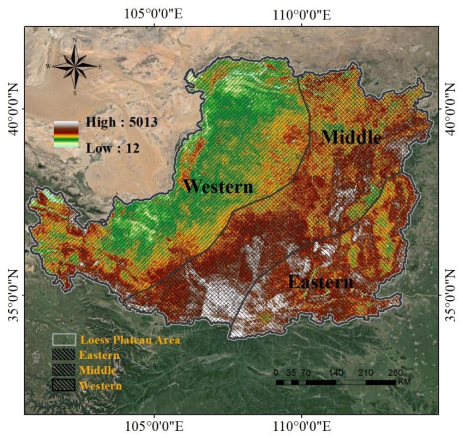
This study aimed to assess the impact of land consolidation projects and climate change on changes in vegetation in the Loess Plateau during 2012–2021. The study also explored the impacts of human activities and climate change on the ecological quality of the Loess Plateau during this period. The spatial and temporal normalized difference combined meteorological monitoring data, project data, and normalized difference vegetation index (NDVI) data that was used to create the vegetation index dataset spanning from 2012–2021. The study discussed and assessed the effectiveness of the project, revealing the following results: 1) A significant increase was observed in the vegetation index of the Loess Plateau region from 2012 to 2021, with an upward trend of 0.0024 per year (P < 0.05). 2) Contributions to changes in vegetation attributed to climatic factors and the anthropogenic factors of the ditch construction project were 82.74 and 17.62%, respectively, with climatic factors dominating and the degree of response of the ditch construction project increasing annually. 3) In the Loess Plateau, climatic variables dominated changes in vegetation. However, land consolidation projects in vegetation factors played a key role in changes in vegetation, and the degree of influence was gradually increasing.
Citation: Hui Kong, Liangyan Yang, Dan Wu, Juan Li, Shenglan Ye. Ditch control and land reclamation promote vegetation recovery in Loess Plateau[J]. Mathematical Biosciences and Engineering, 2024, 21(3): 3784-3797. doi: 10.3934/mbe.2024168
This study aimed to assess the impact of land consolidation projects and climate change on changes in vegetation in the Loess Plateau during 2012–2021. The study also explored the impacts of human activities and climate change on the ecological quality of the Loess Plateau during this period. The spatial and temporal normalized difference combined meteorological monitoring data, project data, and normalized difference vegetation index (NDVI) data that was used to create the vegetation index dataset spanning from 2012–2021. The study discussed and assessed the effectiveness of the project, revealing the following results: 1) A significant increase was observed in the vegetation index of the Loess Plateau region from 2012 to 2021, with an upward trend of 0.0024 per year (P < 0.05). 2) Contributions to changes in vegetation attributed to climatic factors and the anthropogenic factors of the ditch construction project were 82.74 and 17.62%, respectively, with climatic factors dominating and the degree of response of the ditch construction project increasing annually. 3) In the Loess Plateau, climatic variables dominated changes in vegetation. However, land consolidation projects in vegetation factors played a key role in changes in vegetation, and the degree of influence was gradually increasing.

| [1] |
F. Ji, D. Han, L. Yan, S. Yan, J. Zha, J. Shen, Assessment of benthic invertebrate diversity and river ecological status along an urbanized gradient using environmental DNA metabarcoding and a traditional survey method, Sci. Total Environ., 806 (2022), 150587. https://doi.org/10.1016/j.scitotenv.2021.150587 doi: 10.1016/j.scitotenv.2021.150587

|
| [2] |
X. Yao, Y. Cao, G. Zheng, A. T. Devlin, J. S. Khim, Use of life cycle assessment and water quality analysis to evaluate the environmental impacts of the bioremediation of polluted water. Sci. Total Environ., 761 (2021), 143260. https://doi.org/10.1016/j.scitotenv.2020.143260 doi: 10.1016/j.scitotenv.2020.143260
|
| [3] |
R. Pascual-Rico, Z. Morales-Reyes, N. Aguilera-Alcalá, A. Olszańska, E. Sebastián-González, R. Naidoo, et al., Usually hated, sometimes loved: A review of wild ungulates' contributions to people, Sci. Total Environ., 801 (2021), 149652. https://doi.org/10.1016/j.scitotenv.2021.149652 doi: 10.1016/j.scitotenv.2021.149652
|
| [4] |
H. Liu, G. Liu, W. Xing, Functional traits of submerged macrophytes in eutrophic shallow lakes affect their ecological functions, Sci. Total Environ., 760 (2021), 143332. https://doi.org/10.1016/j.scitotenv.2020.143332 doi: 10.1016/j.scitotenv.2020.143332
|
| [5] |
Z. Q. Gao, J. Y. Liu, D. F. Zhuang, The relations analysis between ecological environmental quality of Chinese land resources and population, Can. J. Remote Sens., 1 (1999), 66–70. https://doi.org/10.11834/jrs.19990110 doi: 10.11834/jrs.19990110
|
| [6] |
D. Jarvis, N. Stoeckl, S. Larson, D. Grainger, J. Addison, A. Larson, The learning generated through indigenous natural resources management programs increases quality of life for indigenous people–improving numerous contributors to Wellbeing, Ecol. Econ., 180 (2021), 106899. https://doi.org/10.1016/J.ECOLECON.2020.106899 doi: 10.1016/J.ECOLECON.2020.106899
|
| [7] |
P. Huang, C. Ma, A. Zhou, Assessment of groundwater sustainable development considering geo-environment stability and ecological environment: a case study in the Pearl River Delta, China, Environ. Sci. Pollut. R, 29 (2021), 18010–18035. https://doi.org/10.1007/s11356-021-16924-6 doi: 10.1007/s11356-021-16924-6
|
| [8] |
N. Chai, X. Yi, J. Xiao, T. Liu, Y. Liu, L. Deng, Spatiotemporal variations, sources, water quality and health risk assessment of trace elements in the Fen River, Sci. Total Environ., 757 (2021), 143882. https://doi.org/ 10.1016/j.scitotenv.2020.143882 doi: 10.1016/j.scitotenv.2020.143882
|
| [9] |
T. Zhai, J. Wang, Y. Fang, Y. Qin, L. Huang, Y. Chen, Assessing ecological risks caused by human activities in rapid urbanization coastal areas: Towards an integrated approach to determining key areas of terrestrial-oceanic ecosystems preservation and restoration, Sci. Total Environ., 708 (2020), 135153. https://doi.org/10.1016/j.scitotenv.2019.135153 doi: 10.1016/j.scitotenv.2019.135153
|
| [10] |
F. Shi, S. Liu, Y. Sun, Y. An, S. Zhao, Y. Liu, et al., Ecological network construction of the heterogeneous agro-pastoral areas in the upper Yellow River basin, Agr. Ecosyst. Environ., 302 (2020), 107069. https://doi.org/10.1016/j.agee.2020.107069 doi: 10.1016/j.agee.2020.107069
|
| [11] |
J. Li, Study on the impact of seashore leisure behavior on ecological environment based on water quality analysis, J. Coastal. Res., 115 (2020), 193. https://doi.org/10.2112/JCR-SI115-060.1 doi: 10.2112/JCR-SI115-060.1
|
| [12] |
M. Höglind, D. Cameron, T. Persson, X. Huang, M. V. Oijen, BASGRA_N: A model for grassland productivity, quality and greenhouse gas balance, Ecol. Model., 417 (2020), https://doi.org/10.1016/j.ecolmodel.2019.108925 doi: 10.1016/j.ecolmodel.2019.108925
|
| [13] |
Y. X. Gao, Study on water resources carrying capacity of ChangjiArea based on water quality-ecological system, Ground Water, 26 (2019) 11000–11011, https://doi.org/10.1007/s11356-019-04414-9 doi: 10.1007/s11356-019-04414-9
|
| [14] |
G. Sun, S. J. Hoff, B. C. Zelle, M. A. Nelson, Forecasting daily source air quality using multivariate statistical analysis and radial basis function networks, J. Air Waste Manage., 58 (2019), 1571–1578. https://doi.org/10.3155/1047-3289.58.12.1571 doi: 10.3155/1047-3289.58.12.1571
|
| [15] |
L. C. Evans, R. M. Sibly, P. Thorbek, I. Sims, T. H. Oliver, R. J. Walters, Quantifying the effectiveness of agri-environment schemes for a grassland butterfly using individual-based models, Ecol. Model., 411 (2019), 108798. https://doi.org/10.1016/j.ecolmodel.2019.108798 doi: 10.1016/j.ecolmodel.2019.108798
|
| [16] |
S. R. Corsi, L. A. De Cicco, D. L. Villeneuve, B. R. Blackwell, K. A. Fay, G. T. Ankley, et al., Prioritizing chemicals of ecological concern in Great Lakes tributaries using high-throughput screening data and adverse outcome pathways, Sci. Total Environ., 686 (2019), 995–1009. https://doi.org/10.1016/j.scitotenv.2019.05.457 doi: 10.1016/j.scitotenv.2019.05.457
|
| [17] |
D. Saadoud, M. Hassani, F. J. M. Peinado, M. S. Guettouche, Application of fuzzy logic approach for wind erosion hazard mapping in Laghouat region (Algeria) using remote sensing and GIS, Aeolian Res., 32 (2018), 762–781. https://doi.org/10.3390/sym11060762 doi: 10.3390/sym11060762
|


Figures(6) / Tables(2)

Hui Kong, Liangyan Yang, Dan Wu, Juan Li, Shenglan Ye. Ditch control and land reclamation promote vegetation recovery in Loess Plateau[J]. Mathematical Biosciences and Engineering, 2024, 21(3): 3784-3797. doi: 10.3934/mbe.2024168


 DownLoad: