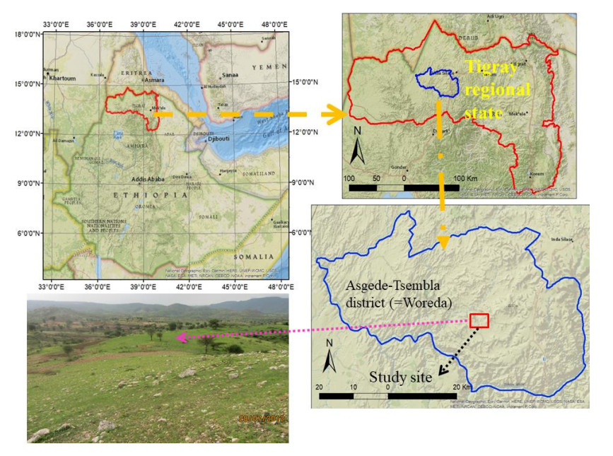
This study presents an engineering geological investigation aimed at assessing the bearing capacity of the proposed site for the Meli gold processing plant (GPP) located in the northwestern region of Tigray, Ethiopia. The geological composition of the site predominantly comprises low-grade metamorphic rocks, with intermediate metavolcanic rocks being the most prevalent. This research utilized an innovative combination of empirical methodologies, including the Hoek–Brown and Mohr–Coulomb criteria, to evaluate the strength and elasticity characteristics of the rock mass. Additionally, the rock mass foundation for the GPP was rigorously classified using renowned systems such as the rock mass rating (RMR), quality index (Q), and geological strength index (GSI). Employing five different empirical equations to estimate bearing capacity, this study significantly advances our understanding by comparing these diverse methodologies, which is a novel approach in this geological context where engineering property data are scarce or non-existent. The bearing capacities determined using the Hoek–Brown and Mohr–Coulomb criteria ranged from 11.6 to 46.2 MPa and 7.9 to 10.5 MPa, respectively. These findings not only offer valuable insights into the assessment of bearing capacity in metamorphic rock formations but also underscore the effectiveness of combining multiple empirical approaches to enhance the reliability of geological assessments. This research contributes to the advancement of construction practices and enhances project planning strategies in comparable geological environments, particularly highlighting the utility of robust empirical data in the absence of extensive drilling data. By integrating comprehensive empirical analyses, the study provides a methodological framework that significantly aids in informed decision-making for future projects located in similar geological settings.
Citation: Shishay T Kidanu, Gebremedhin Berhane, Mogos Amare, Mulubrhan Kebede. Assessment of rock mass properties and load-bearing potential in low-grade metamorphic rocks: A study from the Tigray region, Ethiopia[J]. AIMS Geosciences, 2024, 10(3): 498-523. doi: 10.3934/geosci.2024026
This study presents an engineering geological investigation aimed at assessing the bearing capacity of the proposed site for the Meli gold processing plant (GPP) located in the northwestern region of Tigray, Ethiopia. The geological composition of the site predominantly comprises low-grade metamorphic rocks, with intermediate metavolcanic rocks being the most prevalent. This research utilized an innovative combination of empirical methodologies, including the Hoek–Brown and Mohr–Coulomb criteria, to evaluate the strength and elasticity characteristics of the rock mass. Additionally, the rock mass foundation for the GPP was rigorously classified using renowned systems such as the rock mass rating (RMR), quality index (Q), and geological strength index (GSI). Employing five different empirical equations to estimate bearing capacity, this study significantly advances our understanding by comparing these diverse methodologies, which is a novel approach in this geological context where engineering property data are scarce or non-existent. The bearing capacities determined using the Hoek–Brown and Mohr–Coulomb criteria ranged from 11.6 to 46.2 MPa and 7.9 to 10.5 MPa, respectively. These findings not only offer valuable insights into the assessment of bearing capacity in metamorphic rock formations but also underscore the effectiveness of combining multiple empirical approaches to enhance the reliability of geological assessments. This research contributes to the advancement of construction practices and enhances project planning strategies in comparable geological environments, particularly highlighting the utility of robust empirical data in the absence of extensive drilling data. By integrating comprehensive empirical analyses, the study provides a methodological framework that significantly aids in informed decision-making for future projects located in similar geological settings.

| [1] |
Ozsan A, Akın M (2002) Engineering geological assessment of the proposed Urus Dam, Turkey. Eng Geol 66: 271–281. https://doi.org/10.1016/S0013-7952(02)00047-9 doi: 10.1016/S0013-7952(02)00047-9

|
| [2] |
Merifield RS, Lyamin AV, Sloan SW (2006) Limit analysis solutions for the bearing capacity of rock masses using the generalized Hoek–Brown criterion. Int J Rock Mech Min Sci 43: 920–937. https://doi.org/10.1016/j.ijrmms.2006.02.001 doi: 10.1016/j.ijrmms.2006.02.001
|
| [3] | Kulkarni, R, Pandey VK (2021) Selection of geological parameters for design of footings on basaltic rock. Res J Engineering Sci 10: 43–47. |
| [4] |
Bao H, Liu C, Liang N, et al. (2022) Analysis of large deformation of deep-buried brittle rock tunnel in strong tectonic active area based on macro and microcrack evolution. Eng Failure Anal 138: 106351. https://doi.org/10.1016/j.engfailanal.2022.106351 doi: 10.1016/j.engfailanal.2022.106351
|
| [5] | Kulhawy FH, Goodman RE (1980) Design of foundations on discontinuous rock. Int Conf Structural Foundations Rock, Sydney, Australia, 209–220. |
| [6] |
Bastidas G, Soria O, Soria O, et al, (2022) Stability Analysis of Lava Tunnels on Santa Cruz Island (Galapagos Islands, Ecuador) Using Rock Mass Classifications: Empirical Approach and Numerical Modeling. Geosciences 12: 380. https://doi.org/10.3390/geosciences12100380 doi: 10.3390/geosciences12100380
|
| [7] | Kazmin V (1975) Explanation of the geological map of Ethiopia. Ethiopian Geological Survey Bulletin 1, Geological Survey of Ethiopia archive, 1–15. |
| [8] | Kazmin V (1978) Geology of Ethiopian basement and possible relation between the Mozambique and the Red Sea Belts. Egypt J Geol 22: 73–86. |
| [9] | Shackelton RM (1978) Structural development of the East African Rift System. Geological Society, London, Special Publications. 6: 19–28. https://doi.org/10.1144/GSL.SP.1978.006.01.04 |
| [10] | Drury SA, Berhe SM (1993) Accretion tectonics in northern Eritrea revealed by remotely sensed imagery. Geol Mag 130: 177–190. |
| [11] | Tadesse T (1997) The Geology of Axum area (ND 37–6). Memoir no. 9, Ethiopian Institute of Geological Survey, Addis Ababa, Ethiopia, 184. |
| [12] |
Tadesse T, Hoshino M, Sawada Y (1999) Geochemistry of low-grade metavolcanic rocks from the Pan-African of the Axum area, northern Ethiopia. Precambrian Res 96: 101–124. https://doi.org/10.1016/S0301-9268(99)00008-X doi: 10.1016/S0301-9268(99)00008-X
|
| [13] |
Alemu T (1998) Geochemistry of Neoproterozoic granitoids from the Axum Area, Northern Ethiopia. J Afr Earth Sci 27: 437–460. https://doi.org/10.1016/S0899-5362(98)00072-4 doi: 10.1016/S0899-5362(98)00072-4
|
| [14] | Ulusay R (2015) The ISRM Suggested Methods for Rock Characterization, Testing and Monitoring: 2007–2014. Pergamon Press, Oxford, UK. https://doi.org/10.1007/978-3-319-07713-0 |
| [15] |
International Society for Rock Mechanics (1978) Suggested methods for the quantitative description of discontinuities in rock masses. Int J Rock Mech Min Sci Geomech Abstr 15: 319–368. https://doi.org/10.1016/0148-9062(78)91472-9 doi: 10.1016/0148-9062(78)91472-9
|
| [16] | Rockware (2010) Rockworks15 Manual, 3rd Ed., Rockware, Inc. USA. |
| [17] | Bieniawski ZT (1989) Engineering rock mass classifications: a complete manual for engineers and geologists in mining, civil, and petroleum engineering, Wiley, New York, 251. |
| [18] |
Barton N, Lien R, Lunde J (1974) Engineering classification of rock masses for the design of tunnel support. Rock Mech 6: 189–236. https://doi.org/10.1007/BF01239496 doi: 10.1007/BF01239496
|
| [19] |
Hoek E, Brown ET (1997) Practical estimates of rock mass strength. Int J Rock Mech Min Sci 34: 1165–1186. https://doi.org/10.1016/S1365-1609(97)80069-X doi: 10.1016/S1365-1609(97)80069-X
|
| [20] |
Fookes PG, Sweeney M, Manby CND, et al. (1985) Geological and geotechnical engineering aspects of low-cost roads in mountainous terrain. Eng Geol 21: 1–152. https://doi.org/10.1016/0013-7952(85)90002-X doi: 10.1016/0013-7952(85)90002-X
|
| [21] | Kulhawy FH, Carter JP (1992) Settlement and bearing capacity of foundations on rock masses and socketed foundations in rock masses. Engineering in rock masses, Butterworth-Heinemann, Oxford, 231–245. |
| [22] | Goodman RE (1991) Introduction to Rock Mechanics, 2nd Ed., Wiley, New York, 562. |
| [23] |
Serrano A, Olalla C, Gonzalez J (2000) Ultimate bearing capacity of rock masses based on the modified Hoek-Brown criterion. Int J Rock Mech Min Sci 37: 1013–1018. https://doi.org/10.1016/S1365-1609(00)00028-9 doi: 10.1016/S1365-1609(00)00028-9
|
| [24] | USACE (1994) Rock Foundations. Department of the Army U.S. Army Corps of Engineers Washington, DC. Available from: https://www.scribd.com/document/577794118/rock-foundations-em-111012908 |
| [25] | Ezana Mining Development PLC (2010) Geological report on Meli Gold Project (Technical Report), Mekelle, Ezana Mining Development PLC (Ethiopia) archive. Ethiopia. |
| [26] | Berhane G, Kidanu S, Abera T (2011) Engineering geological study report on Meli Gold project, northwestern zone of Tigray, Ethiopia (Technical Report). Ezana Mining Development PLC, Mekelle, Ezana Mining Development PLC (Ethiopia) archive. Ethiopia. |
| [27] |
Jembere D, Yihdego Y (2016) Engineering Rock Mass Evaluation for a Multi-purpose Hydroelectric Power Plant: Case of Genale Dawa (GD-3), Ethiopia. Geotech Geol Eng 34: 1593–1612. https://doi.org/10.1007/s10706-016-0068-9 doi: 10.1007/s10706-016-0068-9
|
| [28] | Hoek E, Kaiser PK, Bawden WF (2000) Support of underground excavations in hard rock. CRC Press, 215. |
| [29] | Grimstad E, Barton N (1993) Updating the Q-System for NMT. Proc Int Symp on Sprayed Concrete-Modern Use of Wet Mix Sprayed Concrete for Underground Support, Fagernes, Oslo: Norwegian Concrete Assn. Available from: https://www.researchgate.net/publication/312619292_Updating_the_Q-system_for_NMT |
| [30] |
Marinos P, Hoek E (2001) Estimating the geotechnical properties of heterogeneous rock masses such as flysch. Bull Eng Geol Environ 60: 85–92. https://doi.org/10.1007/s100640000090 doi: 10.1007/s100640000090
|
| [31] | Hoek E, Carranza-Torres C, Corkum B (2002) Hoek-Brown failure criterion-2002 edition. Proc NARMS-Tac Conf 1: 267–273. |
| [32] | Rocscience (2007) RocLab software manual. Rocscience Inc., Canada. Available from: https://www.resolutionmineeis.us/documents/rocscience-2007 |
| [33] |
Ozsan A, Karpuz C (1996) Geotechnical rock-mass evaluation of the Anamur dam site, Turkey. Eng Geol 42: 65–70. https://doi.org/10.1016/0013-7952(95)00065-8 doi: 10.1016/0013-7952(95)00065-8
|
| [34] |
Serrano A, Olalla C (1994) Ultimate bearing capacity of rock masses. Int J Rock Mech Min Sci Geomech Abstr 31: 93–106. https://doi.org/10.1016/0148-9062(94)92799-5 doi: 10.1016/0148-9062(94)92799-5
|


Figures(11) / Tables(9)

Shishay T Kidanu, Gebremedhin Berhane, Mogos Amare, Mulubrhan Kebede. Assessment of rock mass properties and load-bearing potential in low-grade metamorphic rocks: A study from the Tigray region, Ethiopia[J]. AIMS Geosciences, 2024, 10(3): 498-523. doi: 10.3934/geosci.2024026


 DownLoad: