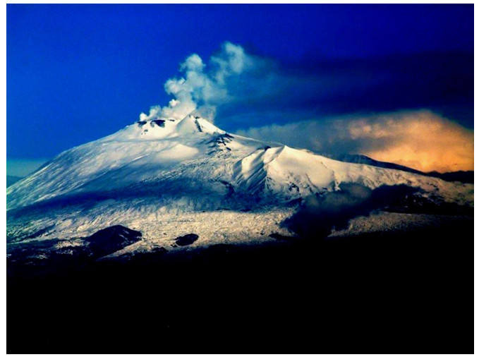
The Etna natural and agricultural landscape, located on the island of Sicily in Italy, is known for its stunning views and unique geology. It is also home to a diverse array of plant and animal life, as well as a rich cultural and agricultural history and quality products. Using GIS (Geographic Information System) analysis, it is possible to quantify and evaluate the value of this landscape, providing a better understanding of the value that the Etna landscape provides to the surrounding region. The study highlights the landscape transformations of Etna over the last years to ensure market integration and support sustainable resource management strategies regarding local cultural heritage and environmental sustainability. Detailed knowledge of landscape dynamics is crucial for many applications, from resource management to governance services assessments.
Citation: Gianni Petino, Donatella Privitera. Uncovering the local foodscapes. Exploring the Etna volcano case study, Italy[J]. AIMS Geosciences, 2023, 9(2): 392-408. doi: 10.3934/geosci.2023021
The Etna natural and agricultural landscape, located on the island of Sicily in Italy, is known for its stunning views and unique geology. It is also home to a diverse array of plant and animal life, as well as a rich cultural and agricultural history and quality products. Using GIS (Geographic Information System) analysis, it is possible to quantify and evaluate the value of this landscape, providing a better understanding of the value that the Etna landscape provides to the surrounding region. The study highlights the landscape transformations of Etna over the last years to ensure market integration and support sustainable resource management strategies regarding local cultural heritage and environmental sustainability. Detailed knowledge of landscape dynamics is crucial for many applications, from resource management to governance services assessments.

| [1] |
Dimopoulos T, Kizos T (2020) Mapping change in the agricultural landscape of Lemnos. Landscape Urban Plan 203: 103894. https://doi.org/10.1016/j.landurbplan.2020.103894 doi: 10.1016/j.landurbplan.2020.103894

|
| [2] |
Janssen J, Luiten E, Renes H, et al. (2017) Heritage as sector, factor and vector: Conceptualizing the shifting relationship between heritage management and spatial planning. Eur Plan Stud 25: 1654–1672. https://doi.org/10.1080/09654313.2017.1329410 doi: 10.1080/09654313.2017.1329410
|
| [3] |
Miocevic D, Mikulic J (2023) Expatriate adjustment and engagement with host country gastronomy: investigating the role of identity projects. J Hosp Tour Res 47: 691–713. https://doi.org/10.1177/10963480211014933 doi: 10.1177/10963480211014933
|
| [4] |
Roe M (2016) Editorial: food and landscape. Landscape Res 41: 709–713. https://doi.org/10.1080/01426397.2016.1226016 doi: 10.1080/01426397.2016.1226016
|
| [5] | OCSE, Rebuilding tourism for the future: COVID-19 policy response and recovery. 2020. Available from: https://www.oecd.org/coronavirus/policy-responses/rebuilding-tourism-for-the-future-covid-19-policy-responses-and-recovery-bced9859/. |
| [6] | United Nation, Transforming our world: the 2030 Agenda for sustainable development. 2015. Available from: https://sdgs.un.org/2030agenda. |
| [7] |
Lugeri FR, Aldighieri B, Farabollini P, et al. (2022) Territorial knowledge and cartographic evolution. AIMS Geosci 8: 452–466. https://doi.org/10.3934/geosci.2022025 doi: 10.3934/geosci.2022025
|
| [8] |
Yeoman I, McMahon-Beattie U (2019) The experience economy: Micro trends. J Tourism Futures 5: 114–119. https://doi.org/10.1108/JTF-05-2019-0042 doi: 10.1108/JTF-05-2019-0042
|
| [9] | Nijhuis S (2019) Mapping the Evolution of Designed Landscapes with GIS. Stourhead Landscape Garden as an Example. In: Coomans T, Cattoor B, De Jonge K, Eds., Mapping Landscapes in Transformation. Multidisciplinary Methods for Historical Analysis, Leuven: Leuven University Press, 95–129. https://doi.org/10.11116/9789461662835 |
| [10] |
Sargentis GF, Siamparina P, Sakki GK, et al. (2021) Agricultural land or photovoltaic parks? The water-energy-food nexus and land development perspectives in the thessaly plain, Greece. Sustainability 13: 8935. https://doi.org/10.3390/su13168935 doi: 10.3390/su13168935
|
| [11] | Bryman A, Bell E (2011) Business Research Methods. 3rd Edition. Oxford: Oxford University Press. |
| [12] |
Evans J, Jones P (2011), The walking interview: Methodology, mobility and place. Appl Geogr 31: 849–858. https://doi.org/10.1016/j.apgeog.2010.09.005 doi: 10.1016/j.apgeog.2010.09.005
|
| [13] | Yin RK (2017) Case study research and applications: Design and methods, London: SAGE Publications. |
| [14] |
Scazzosi L (2018) Rural Landscape as Heritage: Reasons for and Implications of Principles Concerning Rural Landscapes as Heritage ICOMOS-IFLA 2017. Built Heritage 2: 39–52. https://doi.org/10.1186/BF03545709 doi: 10.1186/BF03545709
|
| [15] | Davis DK (2011) Reading landscapes and telling stories. Geography, the humanities and environmental history. In: Daniels S, Eds., Envisioning landscapes, making worlds. Geography and the humanities, London: Routledge, 170–187. |
| [16] |
Lugeri FR, Farabollini P, Lugeri L (2019) Landscape analysis as a tool for risk reduction. AIMS Geosci 5: 617–630. https://doi.org/10.3934/geosci.2019.3.617 doi: 10.3934/geosci.2019.3.617
|
| [17] |
Paniagua A (2021) Countryside, landscape and heritage in (new) historical Geography: Some considerations in the current geographical tendencies. AIMS Geosci 7: 291–299. https://doi.org/10.3934/geosci.2021017 doi: 10.3934/geosci.2021017
|
| [18] | Council of Europe, European Landscape Convention, CETS No. 176. Strasbourg, 2000. Available from: http://www.coe.int/t/dg4/cultureheritage/heritage/Landscape. |
| [19] | Swanwick C (2002) The Countryside Agency, Scottish Natural Heritage, Landscape Character Assessment, Guidance for England and Scotland, Cheltenham (Gloucestershire). Available from: https://publications.naturalengland.org.uk/publication/2671754. |
| [20] |
Fairclough G (2019) Landscape and heritage: ideas from Europe for culturally based solutions in rural environments. J Environ Plan Manag 62: 1149–1165. https://doi.org/10.1080/09640568.2018.1476026 doi: 10.1080/09640568.2018.1476026
|
| [21] |
Butler A, Sarlöv-Herlin I, Knez I, et al. (2018) Landscape identity, before and after a forest fire. Landscape Res 43: 878–889. https://doi.org/10.1080/01426397.2017.1344205 doi: 10.1080/01426397.2017.1344205
|
| [22] |
Albanese V (2022) Global images vs cultural images: mixed methods to deepen territorial representations. AIMS Geosci 8: 593–608. https://doi.org/10.3934/geosci.2022032 doi: 10.3934/geosci.2022032
|
| [23] | Richards G (2021) Evolving research perspectives on food and gastronomic experiences in tourism. Int J Cont Hosp Man 33: 1037–1058. |
| [24] | Richards G (2015) Evolving gastronomic experiences: from food to foodies to foodscapes. J Gastronomy Tourism 1: 5–17. |
| [25] | Di Blasi A (1997) Per una definizione della regione etnea. Etna Mito d'Europa, Catania: Maimone, 9–13. |
| [26] | Privitera S (2018) Il territorio del Monte Etna da Parco Regionale a Patrimonio Naturale Mondiale dell'UNESCO. AGEI Geotema 57: 143–148. |
| [27] | Chester DK, Duncan AM, Guest JE, et al. (1999) Mount Etna: The Anatomy of a Volcano, Stanford: Stanford University Press. |
| [28] | Branca S, Jean-Claude T (2015) L'attività eruttiva dell'Etna degli ultimi 2700 anni, in Carta geologica del vulcano Etna. Memorie Descrittive della Carta Geologica d'Italia 98: 109–116. |
| [29] | Torre S, Trimarchi R (2007) Di qua dal mare delle tenebre: geografi e viaggiatori della tradizione arabo islamica in Sicilia, Catania: Cuecm, 94–105. |
| [30] | La Mesa R (1961) Viaggiatori stranieri in Sicilia, Rocca San Casciano: Universale Cappelli. |
| [31] | Cannizzaro S, Corinto G (2012) La littorina dell'Etna: la Circumetnea come prodotto turistico enograstronomico. Annali del turismo 1: 283–303. |
| [32] |
Chester DK, Duncan AM, Dibben C, et al (1999) Mascali, Mount Etna region Sicily: An example of fascist planning during the 1928 eruption and its continuing legacy. Natural Hazards 19: 29–46. https://doi.org/10.1023/A:1008001003888 doi: 10.1023/A:1008001003888
|
| [33] |
Di Bella A, Petino G, Scrofani L (2019) The Etna macro-region between peripheralization and innovation: Towards a smart territorial system based on tourism. Reg Sci Policy Pract 11: 493–507. https://doi.org/10.1111/rsp3.12176 doi: 10.1111/rsp3.12176
|
| [34] | Barca F (2008) An agenda for a reformed cohesion policy. A place-based approach to meeting European Union challenges and expectations. Bruxelles: Commission of the European Communities. |
| [35] | Barca F, Casavola P, Lucatelli S (2014) Strategia nazionale per le Aree interne: definizione, obiettivi, strumenti e governance. Materiali UVAL 31: 24–32. |
| [36] | Pecora A (1968) Sicilia, Collana: Le regioni d'Italia. Torino: UTET. |
| [37] | Linee guida del piano territoriale paesistico regionale, Palermo, Regione Siciliana, Assessorato dei Beni Culturali, Ambientali e della Pubblica Istruzione, 2004. Available from: https://www2.regione.sicilia.it/beniculturali/dirbenicult/bca/ptpr/documentazione%20tecnica%20catania/NORME%20E%20REALAZIONI/norme%20di%20attuazione.pdf. |
| [38] | Petino G (2020) Atlante Siciliano delle aree interne e delle specialities agricole, Aracne: Rome. |
| [39] | Napoli D, Petino G (2017) Il prodotto attrae, il territorio accoglie. Analisi dell'offerta turistica di due areali produttivi IGP siciliani. Annali del Turismo, 153–175. |
| [40] |
Carrà G, Mariani M, Radić I, et al. (2016) Participatory strategy analysis: The case of wine tourism business. Agric Agric Sci Procedia 8: 706–712. https://doi.org/10.1016/j.aaspro.2016.02.050 doi: 10.1016/j.aaspro.2016.02.050
|
| [41] | Qualigeo (2022) Piattaforma multimediale delle Indicazioni Geografiche Italiane. Available from: https://www.qualigeo.eu. |
| [42] |
Franco S, Pancino B, Martella A, et al. (2022) Assessing the Presence of a Monoculture: From Definition to Quantification. Agriculture 12: 1506. https://doi.org/10.3390/agriculture12091506 doi: 10.3390/agriculture12091506
|
| [43] |
Mercatanti L, Gaetano S (2019) Volcanic risk and the role of the media. A case study in the Etna area. AIMS Geosci 5: 448–460. https://doi.org/10.3934/geosci.2019.3.448 doi: 10.3934/geosci.2019.3.448
|
| [44] |
Harrop SR (2007) Traditional agricultural landscapes as protected areas in international law and policy. Agric Ecosyst Environ 121: 296–307. https://doi.org/10.1016/j.agee.2006.12.020 doi: 10.1016/j.agee.2006.12.020
|
| [45] |
Kristensen LS, Thenail C, Kristensen SP (2004) Landscape changes in agrarian landscapes in the 1990s: the interaction between farmers and the farmed landscape. A case study from Jutland, Denmark. J Environ Manage 71: 231–244. https://doi.org/10.1016/j.jenvman.2004.03.003 doi: 10.1016/j.jenvman.2004.03.003
|
| [46] |
Ioannidis R, Koutsoyiannis D (2020) A review of land use, visibility and public perception of renewable energy in the context of landscape impact. Appl Energy 276: 115367. https://doi.org/10.1016/j.apenergy.2020.115367 doi: 10.1016/j.apenergy.2020.115367
|


Figures(7) / Tables(2)

Gianni Petino, Donatella Privitera. Uncovering the local foodscapes. Exploring the Etna volcano case study, Italy[J]. AIMS Geosciences, 2023, 9(2): 392-408. doi: 10.3934/geosci.2023021


 DownLoad: