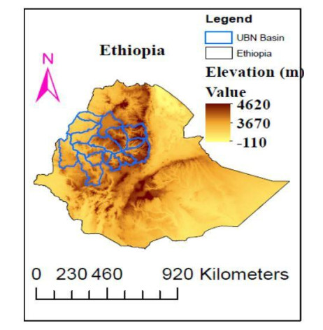
A composite analysis is used to evaluate the teleconnections between the long term (June- August) rainfall anomalies with east and west phases of quasi-biennial oscillation (QBO) in the stratospheric zonal winds from 1979–2017. Applying the lower equatorial stratospheric zonal wind index in JJA rainfall prediction is based on its tendency to persist for several months after the phase change from easterly to westerly and vice versa. Below normal condition rainfall used to coin drought. This study is important because, the Upper Blue Nile region is one of the most inviting areas for different activities like agriculture and hydroelectric power; therefore, timely prediction of June-August rainfall serves farmers and other concerned sectors. The aim of this analysis is to establish the global signal quasi-biennial oscillation contribution alone at different time lags and its association among Southern Oscillation Index (SOI) for estimation June-August rainfall of the Upper Blue Nile. The rainfall used as predictand while quasi-biennial oscillation & SOI datasets are used as predictors in regression model after testing collinearity of these two independent variables. Performance of regression model and actual value is tested by using statistical techniques: Root Mean Square Error, Mean Absolute Error and bias. The performance is seen reasonably high between actual and estimated values show strong agreement.
Citation: Abebe Kebede Habtegebreal, Abebaw Bizuneh Alemu, U. Jaya Prakash Raju. Examining the Role of Quasi-biennial Oscillation on Rainfall patterns over Upper Blue Nile Basin of Ethiopia[J]. AIMS Environmental Science, 2021, 8(3): 190-203. doi: 10.3934/environsci.2021013
A composite analysis is used to evaluate the teleconnections between the long term (June- August) rainfall anomalies with east and west phases of quasi-biennial oscillation (QBO) in the stratospheric zonal winds from 1979–2017. Applying the lower equatorial stratospheric zonal wind index in JJA rainfall prediction is based on its tendency to persist for several months after the phase change from easterly to westerly and vice versa. Below normal condition rainfall used to coin drought. This study is important because, the Upper Blue Nile region is one of the most inviting areas for different activities like agriculture and hydroelectric power; therefore, timely prediction of June-August rainfall serves farmers and other concerned sectors. The aim of this analysis is to establish the global signal quasi-biennial oscillation contribution alone at different time lags and its association among Southern Oscillation Index (SOI) for estimation June-August rainfall of the Upper Blue Nile. The rainfall used as predictand while quasi-biennial oscillation & SOI datasets are used as predictors in regression model after testing collinearity of these two independent variables. Performance of regression model and actual value is tested by using statistical techniques: Root Mean Square Error, Mean Absolute Error and bias. The performance is seen reasonably high between actual and estimated values show strong agreement.

| [1] |
Geller MA, Zhou T, Shindell D, et al. (2016) Modeling the qboimprovements resulting from higher-model vertical resolution. J Adv model earth syst 8: 1092-1105. doi: 10.1002/2016MS000699

|
| [2] |
Dunkerton TJ (1997). The role of gravity waves in the quasi-biennial oscillation. J Geophys Res-Atmos 102: 26053-26076. doi: 10.1029/96JD02999
|
| [3] | Liang C, Eldering A, Gettelman A, et al. (2011) Record of tropical interannual variability of temperature and water vapor from a combined airs-mls data set. J Geophys Res-Atmos 116. |
| [4] |
Randel WJ, Wu F, Oltmans SJ, et al. (2004) Interannual changes of stratospheric water vapor and correlations with tropical tropopause temperatures. J Atmos Sci 61: 2133-2148. doi: 10.1175/1520-0469(2004)061<2133:ICOSWV>2.0.CO;2
|
| [5] |
Collimore CC, Martin DW, Hitchman MH, et al. (2003) On the relationship between the qbo and tropical deep convection. J climate 16: 2552-2568. doi: 10.1175/1520-0442(2003)016<2552:OTRBTQ>2.0.CO;2
|
| [6] | Ho CH, Kim HS, Jeong JH, et al. (2009) Influence of stratospheric quasi-biennial oscillation on tropical cyclone tracks in the western north pacific. Geophys Res Lett 36. |
| [7] | Liess S, Geller MA (2012) On the relationship between qbo and distribution of tropical deep convection. J Geophys Res-Atmos 117. |
| [8] |
Yuan W, Geller MA, Love PT (2014) Enso influence on qbo modulations of the tropical tropopause. Q J Roy Meteor Soc 140: 1670-1676. doi: 10.1002/qj.2247
|
| [9] |
Gray WM, Sheaffer JD, Knaff JA. (1992) Influence of the stratospheric qbo on enso variability. J Meteorol Soc Jpn 70: 975-995. doi: 10.2151/jmsj1965.70.5_975
|
| [10] |
Camberlin P, Philippon N (2002) The east african march-may rainy season: Associated atmospheric dynamics and predictability over the 1968-97 period. J Climate 15: 1002-1019. doi: 10.1175/1520-0442(2002)015<1002:TEAMMR>2.0.CO;2
|
| [11] | Ngongolo HK, Smyshlyaev SP (2010) The statistical prediction of east african rainfalls using quasi-biennial oscillation phases information. Nat Sci 2: 1407. |
| [12] | Seleshi Y, Zanke U. (2004) Recent changes in rainfall and rainy days in ethiopia. International Journal of Climatology: A J Royal Meteorol Soc 24: 973-983. |
| [13] |
Korecha D, Barnston AG (2007) Predictability of june-september rainfall in ethiopia. Mon Weather Rev 135: 628-650. doi: 10.1175/MWR3304.1
|
| [14] | Awulachew SB, Yilma AD, Loulseged M, et al. (2007) Water resources and irrigation development in Ethiopia 123. Iwmi. |
| [15] |
Block P, Rajagopalan B (2007) Interannual variability and ensemble forecast of upper blue nile basin kiremt season precipitation. J Hydrometeorol 8: 327-343. doi: 10.1175/JHM580.1
|
| [16] |
Cane MA (2005) The evolution of el niño, past and future. Earth Planet Sc Lett 230: 227-240. doi: 10.1016/j.epsl.2004.12.003
|
| [17] | Wolde-Georgis T (1997) El nino and drought early warning in ethiopia. Int J Afr Stud 2. |
| [18] |
Trenberth K E (1997) The definition of el nino. B Am Meteorol Soc 78: 2771-2778. doi: 10.1175/1520-0477(1997)078<2771:TDOENO>2.0.CO;2
|
| [19] |
Zaroug MAH, Eltahir EAB, Giorgi F (2014) Droughts and floods over the upper catchment of the Blue Nile and their connections to the timing of El Niño and La Niña events. Hydrol Earth Syst Sci 18: 1239-1249. doi: 10.5194/hess-18-1239-2014
|
| [20] |
Zebiak SE, Cane MA (1987) A model el nino-southern oscillation. Mon Weather Rev 115: 2262-2278. doi: 10.1175/1520-0493(1987)115<2262:AMENO>2.0.CO;2
|
| [21] |
Abtew W, Melesse AM, Dessalegne T (2009) El niño southern oscillation link to the blue nile river basin hydrology. Hydrol Process 23: 3653-3660. doi: 10.1002/hyp.7419
|
| [22] | Charney JG, Drazin PG (1990) Propagation of planetary-scale disturbances from the lower into the upper atmosphere. The Atmosphere—A Challenge. American Meteorological Society, Boston, MA, 1990: 295-321. |
| [23] |
Conway D (1997) A water balance model of the upper blue nile in ethiopia. Hydrolog Sci J 42:2 65-286. doi: 10.1080/02626669709492024
|
| [24] | Steenhuis TS, Collick AS, Easton ZM, et al. (2009) Predicting discharge and sediment for the abay (blue nile) with a simple model. Hydrol Process 23: 3728-3737. |
| [25] |
Conway D (2000) The climate and hydrology of the upper blue nile river. Geogr J 166: 49-62. doi: 10.1111/j.1475-4959.2000.tb00006.x
|
| [26] |
Tesemma ZK, Mohamed YA, Steenhuis TS (2010) Trends in rainfall and runoff in the blue nile basin: 1964-2003. Hydrol Process 24: 3747-3758. doi: 10.1002/hyp.7893
|
| [27] |
Habtegebreal AK, Alemu AB (2019) Identification of rainfall intensity by using bahir dar c-band weather radar products. Int J Comput Sci Appl Math 5: 35-40. doi: 10.12962/j24775401.v5i2.4935
|
| [28] |
Ayehu G, Tadesse T, Gessesse B, et al. (2018) Validation of new satellite rainfall products over the upper blue nile basin, ethiopia. Atmo Meas Tech 11: 1921-1936. doi: 10.5194/amt-11-1921-2018
|
| [29] | Hall G (2015) Pearsons correlation coefficient. other words 1. |
| [30] | Cohen J, Cohen P (1983) Applied multiple regression/correlation analysis for the behavioral sciences (2td eu.). Hillsdale, N]: Lawrence Erlbaum Associates. |
| [31] | Rogerson PA (2001) A statistical method for the detection of geographic clustering. Geogr Anal 33: 215-227. |
| [32] | Bayissa YA, Moges SA, Xuan Y, et al. (2015) Spatio-temporal assessment of meteorological drought under the in- fluence of varying record length: The case of upper blue nile basin, ethiopia. Hydrolog Sci J 60: 1927-1942. |


Figures(6) / Tables(4)

Abebe Kebede Habtegebreal, Abebaw Bizuneh Alemu, U. Jaya Prakash Raju. Examining the Role of Quasi-biennial Oscillation on Rainfall patterns over Upper Blue Nile Basin of Ethiopia[J]. AIMS Environmental Science, 2021, 8(3): 190-203. doi: 10.3934/environsci.2021013


 DownLoad: