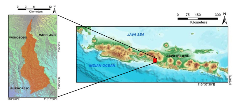
Gully erosion has the ability to transport enormous amounts of soil material, which can degrade tropical volcanic landscapes as the highest potential of agricultural land. It is critical to understand gully erosion control activities in order to reduce the initiation and development of gully erosion. The goals of this study were to: 1) classify the different forms of gully control; 2) pinpoint the advantages and disadvantages of the gully control system; and 3) suggest forthcoming changes to gully erosion control systems in tropical volcanic landscapes. Field surveys employing random sampling were used to collect data on gully erosion points and control system. The findings of the study were explained using exploratory descriptive analysis. The research findings demonstrate that gully erosion control was accomplished through biological (vegetative), mechanical and combination methods, which were classified into nine categories. While mechanical methods have benefits in terms of strength in slowing the rate of gully growth, biological systems have advantages in terms of cost and energy. Adopting a continuous live wicker and wicker check dam system might assist in preventing cracks in the gully dimension. This study's findings can potentially reduce gully erosion susceptibility for local communities and are expected to be implemented globally in settings with similar features. Further research could be conducted on multiple tropical volcanoes with comparable issues in order to improve the performance of research results.
Citation: Edwin Maulana, Junun Sartohadi, Muhammad Anggri Setiawan. Soil conservation at the gully plot scale in the tropical volcanic landscape of Sumbing[J]. AIMS Environmental Science, 2023, 10(6): 832-846. doi: 10.3934/environsci.2023045
Gully erosion has the ability to transport enormous amounts of soil material, which can degrade tropical volcanic landscapes as the highest potential of agricultural land. It is critical to understand gully erosion control activities in order to reduce the initiation and development of gully erosion. The goals of this study were to: 1) classify the different forms of gully control; 2) pinpoint the advantages and disadvantages of the gully control system; and 3) suggest forthcoming changes to gully erosion control systems in tropical volcanic landscapes. Field surveys employing random sampling were used to collect data on gully erosion points and control system. The findings of the study were explained using exploratory descriptive analysis. The research findings demonstrate that gully erosion control was accomplished through biological (vegetative), mechanical and combination methods, which were classified into nine categories. While mechanical methods have benefits in terms of strength in slowing the rate of gully growth, biological systems have advantages in terms of cost and energy. Adopting a continuous live wicker and wicker check dam system might assist in preventing cracks in the gully dimension. This study's findings can potentially reduce gully erosion susceptibility for local communities and are expected to be implemented globally in settings with similar features. Further research could be conducted on multiple tropical volcanoes with comparable issues in order to improve the performance of research results.

| [1] |
Pourghasemi HR, Yousefi S, Kornejady A, et al. (2017) Performance assessment of individual and ensemble data-mining techniques for gully erosion modeling. Sci Total Environ 609: 764–775. https://doi.org/10.1016/j.scitotenv.2017.07.198 doi: 10.1016/j.scitotenv.2017.07.198

|
| [2] |
Raji SA, Akintuyi AO, Wunude EO, et al. (2023) A machine learning-based spatial statistical method for modelling different phases of gully development in South-Eastern Nigeria. Ecol Inform 75: 102101. https://doi.org/10.1016/j.ecoinf.2023.102101 doi: 10.1016/j.ecoinf.2023.102101
|
| [3] |
Majumdar S, Kose M, Chatterjee U (2021) Gully Erosion Mapping by Multi-criteria Decision Analysis Techniques and Geoinformatics in Adana Province, Turkey. Earth Syst Environ https://doi.org/10.1007/s41748-020-00198-y doi: 10.1007/s41748-020-00198-y
|
| [4] |
Vanmaercke M, Panagos P, Vanwalleghem T, et al. (2021) Measuring, modelling and managing gully erosion at large scales: A state of the art. Earth-Science Rev 218. https://doi.org/10.1016/j.earscirev.2021.103637 doi: 10.1016/j.earscirev.2021.103637
|
| [5] |
Phinzi K, Holb I, Szabó S (2021) Mapping Permanent Gullies in an Agricultural Area Using Satellite Images: Efficacy of Machine Learning Algorithms. Agronomy 11: 333. https://doi.org/10.3390/agronomy11020333 doi: 10.3390/agronomy11020333
|
| [6] |
Tang J, Xie Y, Liu C, et al. (2022) Effects of rainfall characteristics and contour tillage on ephemeral gully development in a field in Northeastern China. Soil Tillage Res 218: 105312. https://doi.org/10.1016/j.still.2021.105312 doi: 10.1016/j.still.2021.105312
|
| [7] |
Kariminejad N, Pourghasemi HR, Hosseinalizadeh M (2022) Analytical techniques for mapping multi ‑ hazard with geo ‑ environmental modeling approaches and UAV images. Sci Rep 1–17. https://doi.org/10.1038/s41598-022-18757-w doi: 10.1038/s41598-022-18757-w
|
| [8] |
Liu Z, Shen X, Wei Y, et al. (2023) Soil depth mapping and its linkage to gully erosion rate prediction in granite areas of southern China. Soil Tillage Res 231: 105711. https://doi.org/10.1016/j.still.2023.105711 doi: 10.1016/j.still.2023.105711
|
| [9] |
Blanco-Sepúlveda R, Enríquez-Narváez F, Lima F (2021) Effectiveness of conservation agriculture (tillage vs. vegetal soil cover) to reduce water erosion in maize cultivation (Zea mays L.): An experimental study in the sub-humid uplands of Guatemala. Geoderma 404. https://doi.org/10.1016/j.geoderma.2021.115336 doi: 10.1016/j.geoderma.2021.115336
|
| [10] |
Eekhout JPC, de Vente J (2022) Global impact of climate change on soil erosion and potential for adaptation through soil conservation. Earth-Science Rev 226: 103921. https://doi.org/10.1016/j.earscirev.2022.103921 doi: 10.1016/j.earscirev.2022.103921
|
| [11] |
Du X, Jian J, Du C, et al. (2022) Conservation management decreases surface runoff and soil erosion. Int Soil Water Conserv Res 10: 188–196. https://doi.org/10.1016/j.iswcr.2021.08.001 doi: 10.1016/j.iswcr.2021.08.001
|
| [12] |
Borrelli P, Robinson DA, Fleischer LR, et al. (2017) An assessment of the global impact of 21st century land use change on soil erosion. Nat Commun 8. https://doi.org/10.1038/s41467-017-02142-7 doi: 10.1038/s41467-017-02142-7
|
| [13] |
Zhang Y, Qin X, Qiu Q, et al. (2023) Soil and water conservation measures reduce erosion but result in carbon and nitrogen accumulation of red soil in Southern China. Agric Ecosyst Environ 346: 108346. https://doi.org/10.1016/j.agee.2023.108346 doi: 10.1016/j.agee.2023.108346
|
| [14] |
Wen X, Zhen L (2020) Soil erosion control practices in the Chinese Loess Plateau: A systematic review. Environ Dev 34: 100493. https://doi.org/10.1016/j.envdev.2019.100493 doi: 10.1016/j.envdev.2019.100493
|
| [15] |
Liu X, Li H, Zhang S, et al. (2019) Gully erosion control practices in Northeast China: A review. Sustain 11. https://doi.org/10.3390/su11185065 doi: 10.3390/su11185065
|
| [16] |
Wen Y, Kasielke T, Li H, et al. (2021) May agricultural terraces induce gully erosion? A case study from the Black Soil Region of Northeast China. Sci Total Environ 750: 141715. https://doi.org/10.1016/j.scitotenv.2020.141715 doi: 10.1016/j.scitotenv.2020.141715
|
| [17] |
Lira-Caballero VG, Martínez-Menez MR, Romero-Manzanares A, et al. (2018) Initial floristic composition of rehabilitated gullies through bioengineering in the Mixteca Region, Sierra Madre del Sur, Mexico. J Mt Sci 15: 2120–2135. https://doi.org/10.1007/s11629-018-4899-0 doi: 10.1007/s11629-018-4899-0
|
| [18] | Ezezika OC, Adetona O (2011) Resolving the gully erosion problem in Southeastern Nigeria: Innovation through public awareness and community-based approaches. J Soil Sci Environ Manag 2: 286–291. http://www.academicjournals.org/JSSEM |
| [19] |
Peterson RB, Kapiyo RA, Campbell EM, et al. (2018) Gully Rehabilitation Trusts: Fighting soil erosion through community participation in western Kenya. J Rural Stud 58: 67–81. https://doi.org/10.1016/j.jrurstud.2017.12.028 doi: 10.1016/j.jrurstud.2017.12.028
|
| [20] | Maulana E, Sartohadi J, Setiawan MA (2023) AHP GIS-Based Gully Erosion Susceptibility Modelling in Tropical Volcano Environment. Journal of Hunan University Natural Sciences. |
| [21] |
Wida WA, Maas A, Sartohadi J (2019) Pedogenesis of Mt. Sumbing Volcanic Ash above The Alteration Clay Layer in The Formation of Landslide Susceptible Soils in Bompon Sub-Watershed. Ilmu Pertanian (Agricultural Science) 4: 15. https://doi.org/10.22146/ipas.41893 doi: 10.22146/ipas.41893
|
| [22] |
Effendy Z, Setiawan MA, Mardiatno D (2019) Geospatial-Interface Water Erosion Prediction Project (GeoWEPP) application for the planning of Bompon Watershed conservation-prioritized area, Magelang, Central Java, Indonesia. IOP Conf Ser Earth Environ Sci 256. https://doi.org/10.1088/1755-1315/256/1/012017 doi: 10.1088/1755-1315/256/1/012017
|
| [23] |
Nugraha SS, Sartohadi J (2018) Faktor yang Berpengaruh Terhadap Tingkat Kerapatan Erosi Parit Di Daerah Aliran Sungai Kaliwungu. J Penelit Pengelolaan Drh Aliran Sungai 2: 73–88. [in Bahasa] https://doi.org/10.20886/jppdas.2018.2.1.73-88 doi: 10.20886/jppdas.2018.2.1.73-88
|
| [24] |
Wilkinson SN, Kinsey-Henderson AE, Hawdon AA, et al. (2018) Grazing impacts on gully dynamics indicate approaches for gully erosion control in northeast Australia. Earth Surf Process Landforms 43: 1711–1725. https://doi.org/10.1002/esp.4339 doi: 10.1002/esp.4339
|
| [25] |
Luffman IE, Nandi A, Spiegel T (2015) Gully morphology, hillslope erosion, and precipitation characteristics in the Appalachian Valley and Ridge province, southeastern USA. Catena 133: 221–232. https://doi.org/10.1016/j.catena.2015.05.015 doi: 10.1016/j.catena.2015.05.015
|
| [26] |
Wang R, Sun H, Yang J, et al. (2022) Quantitative Evaluation of Gully Erosion Using Multitemporal UAV Data in the Southern Black Soil Region of Northeast China: A Case Study. Remote Sens 14. https://doi.org/10.3390/rs14061479 doi: 10.3390/rs14061479
|
| [27] |
Bennett SJ, Wells RR (2019) Gully erosion processes, disciplinary fragmentation, and technological innovation. Earth Surf Process Landforms 44: 46–53. https://doi.org/10.1002/esp.4522 doi: 10.1002/esp.4522
|
| [28] |
Lufira RD, Andawayanti U, Cahya EN, et al. (2022) Land conservation based on erosion and sedimentation rate (case study of Genting Watershed Ponorogo Regency). Phys Chem Earth 126: 103143. https://doi.org/10.1016/j.pce.2022.103143 doi: 10.1016/j.pce.2022.103143
|
| [29] |
Gábris G, Kertész Á, Zámbó L (2003) Land use change and gully formation over the last 200 years in a hilly catchment. Catena 50: 151–164. https://doi.org/10.1016/S0341-8162(02)00141-8 doi: 10.1016/S0341-8162(02)00141-8
|
| [30] |
Zhang C, Wang Y, Shao M (2021) Controlling gully- and revegetation-induced dried soil layers across a slope–gully system. Sci Total Environ 755: 142444. https://doi.org/10.1016/j.scitotenv.2020.142444 doi: 10.1016/j.scitotenv.2020.142444
|
| [31] |
Tang WJ, Liu HH, Liu BY (2013) Effects of gully erosion and gully filling on soil degradation in the black soil region of Northeast China. J Mt Sci 10: 913–922. https://doi.org/10.1007/s11629-013-2560-5 doi: 10.1007/s11629-013-2560-5
|
| [32] |
Yitbarek TW, Belliethathan S, Stringer LC (2012) The onsite cost of gully erosion and cost-benefit of gully rehabilitation: A case study in Ethiopia. L Degrad Dev 23: 157–166. https://doi.org/10.1002/ldr.1065 doi: 10.1002/ldr.1065
|
| [33] |
Liu H, Zhang T, Liu B, et al. (2013) Effects of gully erosion and gully filling on soil depth and crop production in the black soil region, northeast China. Environ Earth Sci 68: 1723–1732. https://doi.org/10.1007/s12665-012-1863-0 doi: 10.1007/s12665-012-1863-0
|
| [34] |
de la Torre--Robles L, Muñoz--Robles C, Huber--Sannwald E, et al. (2023) Functional stability: From soil aggregates to landscape scale in a region severely affected by gully erosion in semi-arid central Mexico. Catena 222. https://doi.org/10.1016/j.catena.2022.106864 doi: 10.1016/j.catena.2022.106864
|
| [35] |
Wang R, Li P, Li Z, et al. (2021) Effects of gully head height and soil texture on gully headcut erosion in the Loess Plateau of China. Catena 207: 105674. https://doi.org/10.1016/j.catena.2021.105674 doi: 10.1016/j.catena.2021.105674
|
| [36] |
Liu J, Liu H (2020) Soil erosion changes during the last 30 years and contributions of gully erosion to sediment yield in a small catchment, southern China. Geomorphology 368: 107357. https://doi.org/10.1016/j.geomorph.2020.107357 doi: 10.1016/j.geomorph.2020.107357
|
| [37] |
Yan Y, Zhang X, Liu J, et al. (2021) The effectiveness of selected vegetation communities in regulating runoff and soil loss from regraded gully banks in the Mollisol region of Northeast China. L Degrad Dev 32: 2116–2129. https://doi.org/10.1002/ldr.3866 doi: 10.1002/ldr.3866
|
| [38] |
Yazie T, Mekonnen M, Derebe A (2021) Gully erosion and its impacts on soil loss and crop yield in three decades, northwest Ethiopia. Model Earth Syst Environ 7: 2491–2500. https://doi.org/10.1007/s40808-020-01018-y doi: 10.1007/s40808-020-01018-y
|


Figures(4) / Tables(4)

Edwin Maulana, Junun Sartohadi, Muhammad Anggri Setiawan. Soil conservation at the gully plot scale in the tropical volcanic landscape of Sumbing[J]. AIMS Environmental Science, 2023, 10(6): 832-846. doi: 10.3934/environsci.2023045


 DownLoad: